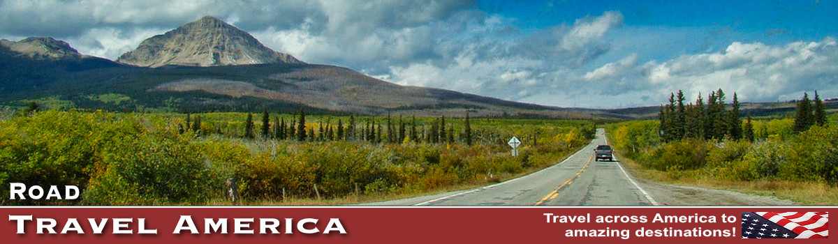
Driving Utah Scenic Byway 12 in 2026
Scenic Byway 12 spans a route of 123 miles in southern Utah, and travels through some of the most diverse, remote and ruggedly beautiful landscapes in the country. It has been designated an "All-American Road".
 Scenic Byway 12 in Utah ... an All-American Road |
It runs through Utah's Garfield and Wayne Counties and is home to two national parks, three state parks, a national recreation area, a national monument, and a national forest. The road climbs from 5,223 feet to 9,636 feet above sea level.
Highway 12 passes through Red Canyon, Bryce Canyon National Park, Grand Staircase-Escalante National Monument and over Boulder Mountain in the Dixie National Forest to its termination in Torrey near the entrance to Capitol Reef National Park.
It is a popular connecting road for tourists visiting both Bryce Canyon and Capitol Reef national parks.
From the west, it begins between Hatch and Panguitch, on U.S. Highway 89, and travels mostly northeast through Bryce Canyon City, Tropic, Cannonville, Henrieville, Escalante and Boulder, ending in Torrey with the byway's intersection with Utah 24.
The road is open year-round, but after major winter storms, sections might be impassible until plowed.
Below we take a road trip on Scenic Byway 12, starting from the west end of the road, and highlighting some of our own original photos we have taken during our many trips on Byway 12!
 Historic Panguitch Inn Motel, downtown, Panguitch, Utah |
The Start of Scenic Byway 12 Near Panguitch and Hatch
Panguitch is located along Highway 89, 7 miles north of the junction with Scenic Byway 12.
We have toured Panguitch, and spent overnight stays there as well. It is a great jumping off locale for tourists to Bryce Canyon, Scenic Byway 12 and Zion National Park.
The city offers a wide range of services to visitors, including lodging, dining, automobile services, museums, campgrounds, a hospital, library and much more.
Visit the City of Panguitch website
Hatch is located next to the winding Sevier River on Highway 89, 8 miles south of the junction with Scenic Byway 12.
The town offers tourist services and various lodging options, fishing venues and campgrounds.
Gentle, winding river near Hatch and the start of Utah Scenic Byway 12

Red Canyon
In addition to its scenery, Red Canyon offers many easily accessible hiking and bicycling trails, a campground and a U.S. Forest Service Visitor Center.
It is located directly on Utah 12. Shown below is the arch over Utah Scenic Highway 12 at Red Canyon, a recreation area managed at the U.S. Forest Service ... 13 miles west of the entrance to Bryce Canyon National Park.
 |
Bryce Canyon National Park
A "must see" stop for visitors to Utah driving Byway 12 ... Bryce Canyon National Park Located in the southwestern section of Utah not far from Scenic Byway 12, Bryce Canyon features the largest collection of hoodoos, odd-shaped pillars of rock left standing from the forces of erosion, in the world. Read more about Bryce Canyon National Park |
|||||
Tropic, Cannonville and HenrievilleAs Utah 12 continues east, it passes through the pleasant town of Tropic. Tropic is one of three towns in Bryce Valley along Scenic Byway 12. It offers more than a dozen lodging options. Only 11 miles from the east entrance of Bryce Canyon National Park, this thriving ranching community is the perfect place to stay when you want to explore Bryce Canyon Country. Further along is the town of Cannonville, home to the annual Old Time Fiddlers and Bear Festival. Just a short distance to both Bryce Canyon National Park and Kodachrome Basin State Park, Cannonville is an ideal base for a number of outdoor adventures and tours. Cannonville offers a variety of lodging, inns, haciendas and campgrounds. Originally settled in the 1870s, the town of Henrieville retains much of its pioneer charm, and is conveniently located to man Byway 12 attractions. |
|||||
Cottonwood Canyon, Kodachrome Basin and Grosvenor ArchCottonwood Canyon Scenic Backway runs for 46 miles traversing southward through Grand Staircase-Escalante National Monument from Cannonville to Highway 89. The road is paved for 9 miles between Cannonville and the turn to Kodachrome Basin State Park. Then the road is graded dirt with an underlying clay base making it impassable when wet. Kodachrome Basin was named during the late 1940s by a National Geographic Society Expedition in honor of the then popular Kodak film. The park offers unusual geological forms, including a series of upright cylindrical chimneys called sand pipes.
The Grosvenor Arch is located within Grand Staircase-Escalante National Monument, near Escalante and close to and south of Kodachrome Basin State Park. It is accessed from the north or south via Road 400, a dirt road that traverses Cottonwood Canyon in the western portion of the national monument. |
|||||
Escalante
|
|||||
Escalante Interagency Visitor Center
|
|||||
Hole-in-the-Rock RoadBeginning 5 miles east of Escalante off Scenic Byway12, the 57-mile-long Hole-in-the-Rock Road is a gravel and dirt road that follows the route taken by Mormon pioneers in 1879-80 in an attempt to establish a shortcut across the Colorado River. Today, Hole-in-the-Rock Road provides access to a number of recreational and historic sites.
|
|||||
Head of the Rocks OverlookHead of the Rocks Overlook provides expansive views across the Escalante Canyons as well as the meandering path of Scenic Byway 12 below. A popular stopping point, plenty of free parking is provided.
|
|||||
The HogsbackBetween Calf Creek Recreation Area and Boulder Town is an internationally famous stretch of byway known as “The Hogsback.” The terrain drops steeply off to each side of the road's hairpin turns toward the creeks and canyons below. Driving is slow and cautious, but the vistas are incredible.
|
|||||
Boulder TownBoulder Town was long known as the last frontier in Utah, as the town was isolated until 1935, and mail was delivered by horseback rider and fresh milk was delivered by mules. Anasazi State Park Museum is located in town on the site of an Ancestral Puebloan habitation that archaeologists believe was occupied between A.D. 1050 and 1175. Boulder takes its name from nearby Boulder Mountain, a vast timbered plateau of the Dixie National Forest that rises to 11,316 feet. The Boulder population today totals about 180 residents. The area offers bountiful camping, off-roading, hiking and other outdoor activities and options. Several lodging and dining options are available in Boulder.
|
|||||
|
|||||
Burr Trail Scenic BackwayThe Burr Trail, which begins at Boulder, and ends at Bullfrog, is one of our favorite back roads in the country. We have driven it several times, sometimes in a 4x4 Jeep, other times in a 2WD Toyota 4Runner. It is typically quiet, with little or no traffic. In earlier years the entire length of the road was dirt; today parts are paved. The drive and views are stunning! The switchbacks are breathtaking! The road which connects Boulder with Bullfrog passes through the painted rock country of Glen Canyon National Recreation Area, Capitol Reef National Park, and Grand Staircase-Escalante National Monument.
Driving time from the Bullfrog Visitor Center to Boulder is about 2 hours, while continuing on to the Escalante Visitor Center will make the total trip about 3 hours. The trip can take longer depending on how many stops are made along the way. Part of the trail is paved, the unpaved part is accessible via a typical passenger car most times of the year. One way mileage is approximately 67 miles. About 30 miles are paved. Read more about the Burr Trail |
|||||
Hell's Backbone RoadConstruction of Hell's Backbone Road was completed in 1933 by Civilian Conservation Corps (CCC), allowing vehicle traffic between Escalante and Boulder for the first time. Hell's Backbone Bridge offers great photo ops as it passes above Sand Creek with views of the spectacular Box-Death Hollow Wilderness Area.
|
|||||
Torrey on Highway 24As it winds along the east banks of Boulder Mountain, Scenic Byway 12 climbs to an altitude of more than 9,000 feet and presents breathtaking views of the rugged landscape stretching out below. Thousands of Aspen trees offer color in the summer and fall. Torrey is the Eastern Gateway to Scenic Byway 12 and lies about 9 miles west of Capitol Reef National Park. It was settled in the 1880s The Wayne County Travel Council and U.S. Forest Service Visitor Information Center are located in Torrey, and provide maps, brochures, and area travel information. The Capitol Reef Visitor Center, constructed of native stone and located just east of Torrey, provides information on travel, weather, trails, and backcountry conditions. A short orientation video is shown in the small theatre.
The most popular feature of Capitol Reef National Park is the Waterpocket Fold, a 100-mile-long monocline, or fold, in the Earth's crust that towers as much as 2,000 feet above its eastern base. The Notom Road Scenic Backway leaves from Highway 24, along the east side of Capitol Reef National Park to the junction of Burr Trail Road in the southern section of the Park. Allow up to two hours to make the trip. |
|||||


Map of Utah Scenic Byway 12

Interactive Map of Utah Scenic Byway 12
More Information about Scenic Byway 12
More About the Burr Trail
Read more about the Burr Trail, with photographs, travel information and maps
Burr Trail at the ScenicByway12.com website
Burr Trail on the Glen Canyon National Recreation area official website at NPS
More Information About Boulder
Boulder on VisitUtah.com website
Read more about the community of Boulder Utah on this website
More Information about Bryce Canyon
Bryce Canyon National Park official website at NPS
The address of the park is P.O. Box 640201, Bryce, UT 84764. Phone 435.834.5322