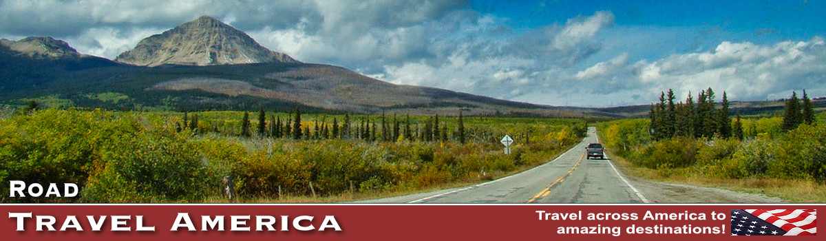
Million Dollar Highway in Colorado
 Map of the San Juan Skyway (Courtesy of the Federal Highway Administration) |
Location
New visitors to Colorado have heard about this fabled road and ask "Where exactly is the Million Dollar Highway?"
The 25-mile section of U.S. 550 from Silverton to Ouray is frequently called the Million Dollar Highway. U.S. Highway 550 in Colorado is a two-lane mountainous road. It is one of only two north–south U.S. Highways in Colorado west of the Continental Divide.
The San Juan Skyway makes a 232-mile loop on Highways 550, 62, 145 and 160, and passes through towns such as Ouray, Silverton, Durango, Cortez, and Telluride (see map to the right).
Though the entire 25-mile stretch is known as the Million Dollar Highway, it is really the 12 miles (19 km) south of Ouray through the Uncompahgre Gorge to the summit of Red Mountain Pass which gains the highway its name.
This stretch through the gorge is challenging and potentially hazardous to drive; it is characterized by steep cliffs, narrow lanes, and a lack of guardrails.The ascent of Red Mountain Pass is marked with a number of hairpin curves used to gain elevation, and again, narrow lanes for traffic, many carved directly into the rocky sides of mountains.
| Interactive Google Map of the Million Dollar Highway |
The highway leaves Silverton and proceeds up Mineral Creek Valley before ascending to Red Mountain Pass. The ruins of the Longfellow Mine are visible along the way. The highway then goes through a series of steep grades and hairpin turns before reaching Lookout Point, which offers a stunning view of the town of Ouray.
Three high passes are traversed:
- Coal Bank Pass - 10,640ft
- Molas Pass - 10,970ft
- Red Mountain Pass - 11,018ft
History and Name
The original portion of the Million Dollar Highway was a toll road built by Otto Mears in 1883 to connect Ouray and Ironton. Another toll road was also built over Red Mountain Pass from Ironton to Silverton.
The original route was widened in the 1930s but was still dangerous and narrow. Improvements continue today, but the road can still be hazardous at times due to weather and other hazards.
The origin of the name Million Dollar Highway is disputed. There are several legends, including that it cost a million dollars a mile to build in the 1920s, and that its fill dirt contains a million dollars in gold ore.
Highlights Along the Highway
Along the way, drivers enjoy sites of the Uncompahgre Gorge, Idarado Mine, Animas River, San Juan National Forest, Haviland Lake, Elektra Lake, Twilight Peak, Red Mountain Pass, and more "million-dollar" views that make up the American West. Those interested in history will enjoy early mining towns and structures.
Plus, the historic towns of Ouray and Silverton offer visitors lodging, dining, shopping and a variety of outdoor fun and activities.
We have driven the Million Dollar Highway multiples times, and it is always a thrill. The driving excitement and beautiful vistas are incredible ... highly recommended!
 |
Driving on the Million Dollar Highway
The Million Dollar Highway features several hairpin turns and narrow lanes that are cut directly into the sides of the mountains. It winds and weaves through the mountains and gorges, clinging to tight curves that offer breath-taking views.
The stretch through the Uncompahgre Gorge is particularly challenging and potentially hazardous to drive, and is characterized by steep cliffs, narrow lanes, and a lack of guardrails. The ascent of Red Mountain Pass is marked with a number of hairpin "S" curves used to gain elevation, and again, narrow lanes for traffic, many cut directly into the sides of mountains.
Avalanches, heavy snowfalls and landslides can occur anytime and can sometimes block some sections of the road, being extremely dangerous due to frequent patches of ice.
The 11,018ft Red Mountain Pass is particularly dangerous on its north side, facing Ouray, with its 8% grade, switchbacks, winding curves, minimal shoulders and guardrails, avalanche slide areas and steep drop-offs. The pass is the separation point between the Uncompahgre River and Las Animas River watersheds. Gold ore wagons first crossed here in 1878. Guardrails are not used in many areas, as snowplows need to push the huge accumulations of snow and ice over the side of the highway.
Three main peaks are located at Red Mountain Pass, identified as Red Mountain 1, 2, and 3. These peaks get their color from rich deposits of iron oxide laden rock. In the fall they provide a stunning collage of bright colors.
Near Red Mountain Pass is Black Bear Road, a sometimes treacherous route, which heads west and ends at Telluride.
Driving Tips
Take your time and go slow; these roads are tricky and it's a long way down steep slopes! There are a number of turns around mountains that you'll need to take at 10 mph.
Make sure that you check the weather forecast before you go. Beware that the roads can sometimes close down at the last minute due to treacherous weather or rock slides, so make sure that your trip plans are flexible. Be on the lookout for snow plows and other equipment during snowy weather.
While you can drive the 25-mile stretch in only 45 minutes, most roadtrippers allow about two hours to view the sites and makes stops along the way.
For current road conditions and cams, visit the website of the Colorado Department of Transportation.
 |
Winter Travel on the Million Dollar Highway
The road is kept open year-round. Summer temperatures can range from highs between 70–90 °F (21–32 °C) at the ends of the highway to 50–70 °F (10–21 °C) in the mountain passes.
The snow season starts in October, and snow will often close the road in winter. Chains may be required to drive.
Ouray Colorado
Some call the mountain town of Ouray the Switzerland of America, as it’s situated in a river valley at nearly 8,000 feet, surrounded by the snow-capped San Juan Mountains.
Also known as the “Outdoor Recreation Capitol of Colorado,” the area is the perfect basecamp for explorations in southwest Colorado. It has kept much of its turn-of-the-century charm, and is registered as a Historic District.
Silverton Colorado
Silverton is a National Historic Landmark, home to Animas Forks and the Alpine Loop, and the summer destination for the Durango & Silverton Narrow Gauge Railroad train ride.
With the Weminuche Wilderness close by, Silverton is a recreational paradise in Winter for snowmobiling, skiing, sledding, ice skating, ice climbing, and ice fishing. In Summer, visitors to the area enjoy rafting, backcountry touring, Jeeping (Jeep rentals and Jeep tours are available), ATV and OHV riding, fishing, hiking, biking, rafting, horseback riding, hunting, and camping.
| Old, red trucks at rest in Silverton |
 |
|

A Bit Further South on U.S. 550: Durango
Durango lies about 48 miles south of Silverton on U.S. 550, at its intersection with U.S. 160, at an altitude of 6,512ft above sea level. Main Avenue is a Nationally Registered Historic District through downtown Durango and is home to galleries, boutiques, restaurants, bars, and other businesses. A variety of hotel and lodging options are available.
Durango is known worldwide for the Durango & Silverton Narrow Gauge Railroad, a heritage railroad that operates what was the Denver & Rio Grande Western's Branchline to the historic mining town of Silverton, Colorado. It continues to use historic D&RGW steam locomotives and other historic rail equipment.
More Popular Travel Destinations & Vacations in Colorado |
|
 |
 |
More Information about the Million Dollar Highway
Colorado.com - The Million Dollar Highway
Telluride.com - The Million Dollar Highway
Colorado Department of Transportation - Road Conditions and Cams