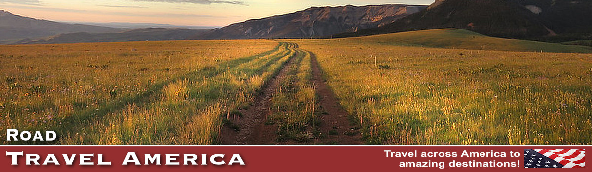
Top Remote Vacation Travel Destinations
Many of us live in large, populous urban areas, characterized by traffic and large crowds. And "social distancing" is difficult, and not much fun.
We all need a break from that environment, and often we travel to remote destinations to clear our minds, and be quiet!
Over the years we have traveled to many peaceful, even dosolate, off-road destinations. We've driven "The Loneliest Road in America" across Nevada, and the dusty roads around Badwater Basin at Death Valley National Park in California. And we rode the ferry to the remote village of Ocracoke on the Outer Banks of North Carolina. And the times we were on the Moki Dugway, there just wasn't any traffic! The Badlands in South Dakota are actually a "good" destination, and are never very crowded. Then there was the trip to Marfa in Texas checking out those "mystery lights" ... we were very alone, and we loved it!
On this site we are including highlights of some of our favorite secluded vacations, along with an assortment of photographs, maps, commentary, lodging suggestions, and reviews.
Here are some travel destinations for you to consider in 2026 ...
Death Valley National Park in CaliforniaThis is the largest U.S. National Park outside Alaska, spanning 3.4 million acres. The park includes low valley floors crusted with barren salt flats, rugged mountains rising as much as 11,000 feet, deep and winding canyons, rolling sand dunes, and spring-fed oases. It offers many opportunities to be alone with your family and friends, hiking, driving or camping. Badwater Basin, at 282 feet below sea level, is not only the lowest place in the park, it's the lowest in North America. Read more about Death Valley National Park |
|
The James Dalton Highway in AlaskaThe James W. Dalton Highway is a rough, industrial road that begins 84 miles (134 km) north of Fairbanks and ends 414 miles (662 km) later in Deadhorse, the industrial camp at Prudhoe Bay. The highway, which directly parallels the pipeline, is one of the most isolated roads in the United States. There are only three towns along the route: Coldfoot (pop 10) at Mile 175, Wiseman (pop 22) at Mile 188, and Deadhorse (25 permanent residents, 3,500-5,000 or more seasonal residents depending on oil production) at the end of the highway at Mile 414. In 1981, the State of Alaska named the highway after James W. Dalton, a lifelong Alaskan and expert in arctic engineering who was involved in early oil exploration efforts on the North Slope. |
|
Loneliest Road in America: U.S. 50 Across NevadaU.S. Highway 50 (US 50) is a historic transcontinental highway which stretches from Sacramento, California in the west, to Ocean City, Maryland on the east coast. The highway crosses the central portion of Nevada, from the west side of the state near Lake Tahoe to the east side near Great Basin National Park. The route was constructed over a historic corridor, first used for the Pony Express and Central Overland Route, and later for the Lincoln Highway. The Nevada portion of U.S. 50 was named "The Loneliest Road in America" by Life magazine in July 1986. Read more about Loneliest Road in America |
|
Marfa, TexasMarfa is a remote small city in the high desert of the Trans-Pecos in far West Texas, located between the Davis Mountains and Big Bend National Park. It is the county seat of Presidio County, and is located at the intersection of U.S. Highway 90, U.S. Highway 67 and Texas Highway 17. Founded in the 1880s, Marfa is today a tourist destination and a major center for Minimalist art. Attractions include Building 98, the Chinati Foundation, artisan shops, historical architecture, a classic Texas town square, modern art installments, art galleries, and the Marfa lights. The area around Marfa is known as a cultural center for contemporary artists and artisans. A not to be missed sight is Prada Marfa, about 26 miles from Marfa, considered to be pop architectural land art. The Marfa Mystery Lights are visible on clear nights between Marfa and the Paisano Pass when one is facing southwest (toward the Chinati Mountains). At times the lights appear colored as they twinkle in the distance. They move about, split apart, melt together, disappear, and reappear. Residents of the area have watched the lights for over a hundred years. Lodging is available in Marfa as well as in nearby Alpine, Marathon and in the Davis Mountains area. Read more about Marfa and the Mystery Lights |
|
Ocracoke, North CarolinaOne of our favorite destinations is the Outer Banks of North Carolina, and over the years we've stayed on many hotel and condo properties. IT IS REMOTE! At just a little over a square mile, and surrounded by water, access is by private boat, small plane, or NCDOT ferry. During our most recent trip, we drove from the south, arriving at Cedar Island and taking the ferry to Ocracoke. Everything within the Village of Ocracoke is conveniently located for walking or biking. With a year-round population of just under 1,000, Ocracoke Village is a quiet respite from the hustle and bustle of mainland living. Ocracoke Village is on the National Register of Historic Places, with houses and buildings dating from the 1880s, along with more recent additions under the canopy of live oaks, cedars, and yaupons. Read more about Ocracoke and the Outer Banks |
|
Boulder, Utah ... Population 180On Utah Scenic Byway 12 is located the small community of Boulder, 32 miles north of the town of Escalante, and 40 miles south of Torrey. Boulder takes its name from nearby Boulder Mountain, a vast timbered plateau of the Dixie National Forest that rises to 11,316 feet. According to the town, it was the last in the nation to receive mail by mule train, changed only by the completion of a year-round road in 1939. The Boulder population today totals about 180 residents. The community is a popular jumping off destination for road trips along Utah Scenic Byway 12 and the Hogsback, the Hell's Backbone Scenic Road, the Cottonwood Canyon Road Scenic Backway, Hole-in-the-Rock Scenic Backway and the Bull Trail Scenic Backway. The area offers bountiful camping, off-roading, hiking and other outdoor activities and option Read more about Boulder Utah |
|
Badlands National Park in South DakotaBadlands National Park is located in southwestern South Dakota, near Rapid City and Mount Rushmore Memorial Park, and features sharply eroded buttes, pinnacles and spires surrounded by a mixed-grass prairie ecosystem. It is not on the main roads of the area, and is fairly remote, but so worth the journey! Situated in the the Northern Great Plains and named Mako Sica by the Lakota people, Badlands National Park has spectacular landscapes, native mixed grass prairie, a large variety of native wildlife, amazing fossils, wonderful skyscapes, and compelling human history. Read more about Badlands National Park |
|
Yakutat, AlaskaLocated on the scenic Gulf of Alaska, Yakutat is 226 nautical miles from Juneau and 302 nautical miles from Whittier. Yakutat is situated on a glacial moraine, surrounded by the highest coastal mountains on earth, and has been inhabited for hundreds of years by the Tlingit people, now known as the Yakutat Tlingit Tribe. Malaspina Glacier, the largest piedmont glacier in North America, and Hubbard Glacier, the largest tidewater glacier in North America are easily accessible from Yakutat. The Hubbard Glacier is located about 30 miles north off the coast of Yakutat and is by far one of Alaska’s most exciting natural treasures. Surrounded by Wrangell-St. Elias National Park and Preserve and the Tongass National Forest, Yakutat attracts a wide variety of outdoor enthusiasts to hike beaches, float rivers, explore bays and passages, climb mountains, view glaciers, snowboard, and surf remote breaks. With no roads into Yakutat most visitors arrive by air. Unlike many rural Alaskan destinations, the jet service offered by Alaska Airlines from Seattle and Anchorage makes access fairly easy. The Alaska Marine Highway ferry "Kennicott" lands every week on a north/south alternate route from April through November. A number of cruise lines offer trips to view the Hubbard Glacier, including Holland America, Silversea, Princess, Seabourn, Royal Caribbean, Celebrity, Carnival and others. Read more about Yakutat and the Hubbard Glacier |
|
Four Corners MonumentFour Corners Monument is a unique place where four states comes together: Colorado, Utah, New Mexico and Arizona. The Monument is located about 85 miles west of Durango, Colorado, and about 80 miles east of Kayenta, Arizona. To reach to the Monument, turn off US Highway 160 onto New Mexico Highway 597. The original marker erected in 1912 was a simple cement pad, but has since been redone in granite and brass. The Visitor Center is open year round, and features a Demonstration Center with Navajo artisans. Navajo vendors sell handmade jewelry, crafts and traditional Navajo foods nearby. The monument also marks the boundary between two semi-autonomous native American governments, the Navajo Nation, which maintains the monument as a tourist attraction, and the Ute Mountain Ute Indian Reservation. Read more about Four Corners Monument |
|
Olympic National Park in WashingtonOlympic National Park is located in northwestern Washington in the north central part of the Olympic Peninsula. The park spans nearly a million acres and features snow-covered mountains, lush rain forests and the dramatic Pacific Ocean coastline. The park offers a large variety of things to do, including boating, camping, hiking, fishing, tidepooling, backpacking, wildlife viewing, climbing and photography. There are many locations in the rain forest, high in the mountains, or along the Pacific coast for peace, quiet and solitude. Read more about Olympic National Park |
|
Golden Spike National Historic SiteWe had long listed a visit to Promontory, Utah as one of our "must see" destinations. In May 2016, we finally visited the Golden Spike National Historic Site on a quiet, blue-sky day. The site is fairly remote, about 87 miles generally northeast of Salt Lake City. It is located off State Highway 83, which is accessible from I-15 near Brigham City or I-84 near Howell. You can also reach Highway 83 via Highway 102 west of Tremonton. The crowds were minimal, and we were impressed with the remoteness of the location, and awed by the work that was done to complete the transcontinental railroad at that point. In May 1869, the railheads of the Union Pacific and Central Pacific railroads finally met at Promontory Summit, followed by the ceremonial driving of the Last Spike. The visitor center offers excellent historical overviews of the site. Periodic runs of the steam engines are also held. Read more about Golden Spike |
|
Monument Valley Navajo Tribal ParkMonument Valley Navajo Tribal Park is located in extreme southeastern Utah, on the northern border of Arizona. It is operated by the Navajo Nation, not the National Park Service. The valley is host to towering sandstone rock formations that have been sculpted over time and soar 400 to 1,000 feet above the valley floor. Over the years, Monument Valley has been the locale for the filming of numerous movies starring such film legends as John Wayne. Read more about Monument Valley Navajo Tribal Park |


 Remote solitude at Icy Strait Point, Hoonah, Alaska |