Map of Popular 2026 Travel Destinations
 |
 |
 |
On this website our staff reviews some of our favorite travel hotspots and vacation destinations across North America.
Whether you are flying to a favorite seashore, roadtripping by car, soaking up luxury train travel, leisurely RVing, open road motorcyle trips or vacations on a cruise ship, this website can help you with your trip planning!
Our travel guides reveal the best places to go, along with first-hand experiences, personal recommendations, free maps and original photographs from our trips.
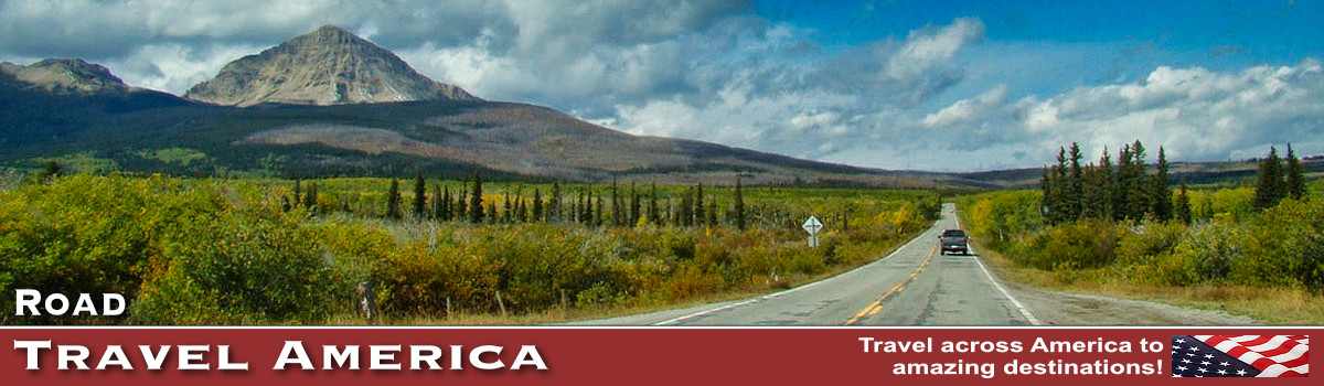
We love traveling around North America, and exploring the many exciting places and get-a-ways that the USA and Canada have to offer. We also love the adventure of the open roads, like cross-country trips on Route 66 The Mother Road. From the Beartooth Highway to the Blue Ridge Parkway, from Utah Scenic Byway 12 to the Trans Canada Highway, it is always a fun driving adventure.
Flying to your family beach destination this year? Check out our Travel Guide to the Top 10 Beach & Seashore Vacations.
Many of our RV enthusiasts enjoy the many popular national parks such as the Great Smoky Mountains National Park and other attractions like Mount Rushmore.
If you are embarking on a cruise ship this year, be sure to explore out our newly published Alaska Travel Guide and Cruises from Vancouver's Canada Place. Those taking a rail trip might enjoy our Banff and Lake Louise Travel Guide, one of our favorite destinations in Canada.
Hopefully our travel experiences will be of interest and benefit to website viewers as they book their travel itineraries for 2025.
The interactive map below highlights many of the more popular travel destinations in America, including favorite travel cities, national parks, scenic byways, historic sites, and museums.
Road Travel America ... Map of Popular Travel Destinations Zoom / pan map for more detail, and click on icons for details about travel destinations |
|
|
Trending Destinations |
||
 |
The mountain village of Estes Park is located 7,522 feet above sea level, nestled in the heart of the Colorado Rocky Mountains. Shops, galleries and boutiques line the main street, which has a quaint, small-town feel and ambiance. |
|
 |
Monument Valley Navajo Tribal Park is located in extreme southeastern Utah, on the northern border of Arizona. The valley is host to towering sandstone rock formations that have been sculpted over time and soar 400 to 1,000 feet above the valley floor. Combined with the surrounding mesas, buttes, and desert environment, Monument Valley is one of the natural wonders of the world. |
|
 |
The iconic Mount Rushmore National Memorial is located in the southwestern corner of South Dakota, and features massive 60-foot (18-m) sculptures of four former United States presidents. | |
 |
Located on Mount Desert Island and close to the popular Acadia National Park, Bar Harbor is the island's largest town. Other villages on the island include Southwest Harbor, Tremont and Northwest Harbor. | |
 |
Vancouver is one of the most diverse, and exciting, cities in North America! Our staff has traveled there by car on the Trans Canada Highway, flew into the Vancouver International Airport, embarked on a cruise ship from Canada Place, and arrived in the city via ferry from Victoria. Once there, the attractions are endless! | |
 |
Destin is a travel hot spot in the Florida Panhandle. There is lots to do in Destin, with its world famous deep-sea fishing fleet. The beaches are white, and the water is spectacular for swimming and other water activities. | |
Popular Trips on Scenic Byways |
||
 |
"The Mother Road" stretched 2,448 miles from Chicago, heading south through Illinois and Missouri. From there Route 66 turned in a more westward direction through Oklahoma and Texas, with the final stretches in New Mexico and Arizona before ending in Los Angeles. | |
 |
US 50 crosses the central portion of Nevada, from the west side of the state near Lake Tahoe to the east side near Great Basin National Park. The Nevada portion of U.S. 50 was named "The Loneliest Road in America" by Life magazine in July 1986. |
|
 |
U.S. Highway 550 in Colorado is a two-lane mountainous road. It is one of only two north–south U.S. Highways in Colorado which runs west of the Continental Divide. The 25-mile section of U.S. 550 from Silverton to Ouray is frequently called the Million Dollar Highway. |
|
 |
The Moki Dugway is a steep, gravel three mile road located in southeastern Utah, traversing 1,200 feet from the top of Cedar Mesa to the broad valley below. The road is actually part of Utah Highway 261, most of which is paved. | |
 |
The Beartooth Highway, is one of the most scenic drives in the U.S., with views of the Absaroka and Beartooth Mountains, and open high alpine plateaus. The road features glacial lakes, forests, valleys, waterfalls and a variety of wildlife. It traverses a series of steep switchbacks at the Montana-Wyoming border to the 10,947 ft Beartooth Pass. | |
 |
The Burr Trail takes the adventurous traveler into some of Utah's most beautiful and extraordinary country, with views of the Henry Mountains, the colorfully contorted Waterpocket Fold, red Circle Cliffs, and Long Canyon. The famous Burr Trail switchbacks rise steeply up through the canyon. The trail drops nearly 800 feet in about a mile, while zigging and zagging down the Waterpocket Fold. |
|
 |
The Blue Ridge Parkway meanders for 469 miles through Virginia and North Carolina, offering endless outdoor recreational opportunities. It provides a slow-paced and relaxing drive revealing stunning long-range vistas and close-up views of the rugged mountains and landscapes of the Appalachian Highlands. | |
 |
This winding Going to the Sun Road traverses Glacier National Park in Montana from east to west, from St. Mary to Agpar, about 50 miles. Portions of the road remain open all year and provide access to many locations and activities. The opening of the alpine portion varies, based on snowfall and plowing progress. | |
 |
Trail Ridge Road is a paved, 48 mile long scenic highway in Rocky Mountain National Park in Colorado. It connects the park entrances in Grand Lake and Estes Park. The road features switchbacks and hairpin curves, and rises to a height of 12,183 feet above sea level. The road is open seasonally in non-winter months. | |
Travel to National Parks |
||
 |
Yellowstone National Park is the world's first national park. It is located mostly in Wyoming, and spans 63 miles north to south, and 54 miles east to west. Geysers, hiking, camping, bison, elk and more! | |
 |
Smoky Mountains Park spans over 800 square miles in Tennessee and North Carolina, and is one of the most pristine natural areas in the Eastern part of the United States. An endless variety of outdoor activities! | |
 |
Rocky Mountain National Park is located in Colorado, and consists of 415 square miles of spectacular mountain environments. A highlight of the park is Trail Ridge Road which crests at over 12,000 feet. The park also features over 300 miles of hiking trails, lakes and wildlife. | |
 |
Grand Canyon National Park is located in Arizona, and is centered on a Colorado River canyon that is 277 river miles long, up to 18 miles wide, and a mile deep. | |