Alaska 2026 Travel Guide
Alaska is a huge state, with so many options for travel, vacations and exploration!
The largest state (in area) of the United States, Alaska was admitted to the union as the 49th state in 1959, and lies at the extreme northwest of the North American continent.
 Alaska ... the 49th State |
Alaska is divided into five regions: far north, interior, southwest, south central, and Inside Passage. Although it takes a long time to see the entire state, visitors can travel through the regions by ferry, car, bus, cruise ship or airplane.
Of the 20 highest peaks in the United States, 17 are in Alaska. Denali, the highest peak in North America, is 20,320 ft. above sea level. Denali, the Indian name for the peak, means "The Great One."
The Yukon River, almost 2,000 miles long, is the third longest river in the U.S. There are more than 3,000 rivers in Alaska and over 3 million lakes. The largest, Lake Iliamna, encompasses over 1,000 square miles.
Alaska has an estimated 100,000 glaciers, ranging from tiny cirque glaciers to huge valley glaciers. There are more active glaciers and ice fields in Alaska than in the rest of the inhabited world. The largest glacier is the Malaspina at 850 square miles. Five percent of the state, or 29,000 square miles, is covered by glaciers.
By area, Alaska holds more than half of America’s national park lands. With 17 national park units and 16 national wildlife refuges, the options for visits and vacations are plentiful.
On this website we have included an assortment of photographs, maps, commentary, lodging suggestions, and reviews of popular travel destinations in Alaska.
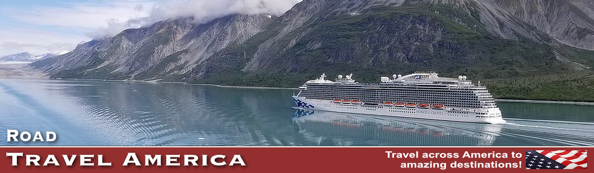
Many visitors to Alaska arrive by cruise ship, most from Seattle, Washington or Vancouver, British Columbia. Read more at our Alaska Cruise Ship Travel Guide for 2026
Map of Major Cities and National Parks in Alaska
| Map showing the locations of major cities and national parks in Alaska |
 |
Popular Destinations in Alaska
JuneauThe City and Borough of Juneau is the capitol of Alaska, located on the Gastineau Channel and the Alaskan Panhandle. Juneau is about 235 air miles north of Ketchikan and 40 miles east of Hoonah. It is situated at the base of Mount Juneau and across the channel from Douglas Island. The Juneau-Douglas Bridge connects the Juneau mainland with Douglas Island. Juneau shares its eastern border with the Canadian province of British Columbia. It is the only U.S. state capital to border another country. There are no roads connecting Juneau to the rest of North America, although cars can use the ferries to connect to the road network. The longest road is Glacier Highway, Alaska Route 7, which extends 40 miles north of downtown. Leaving downtown, the route is known as Egan Drive until the airport. The extreme southern end of Egan Drive is known as Marine Way. Beyond the airport, AK-7 continues north as the Glacier Highway, past Auke Bay to its northernmost point near Berners Bay. Read more about Juneau |
|
 |
|
KetchikanKetchikan, Alaska, is located on Revillagigedo Island in the Alexander Archipelago, part of the southern portion of Alaska’s Inside Passage (Southeast) region. The only way to travel to and from Ketchikan is by boat or plane. It is built on steep hillsides, with some structures built on pilings It is about 235 air miles south of the Alaska Capitol in Juneau and 700 miles northwest of Seattle. Ketchikan was incorporated in 1900 and is named after the Ketchikan Creek streaming into town from the hills above. It is known as the First City of Alaska and the Gateway to Southeast Alaska, because it’s the first town on a northbound travel to Alaska. Long a popular destination for travelers, Ketchikan is Alaska’s second largest cruise port. Visitors enjoy fishing, wildlife viewing, outdoor recreation, thriving native culture and amazing scenery. Read more about Ketchikan |


Anchorage
Alaska’s largest city, Anchorage, lies between the mountains and the sea and yet is no stranger to the wilderness. There is no other urban area like it. Among the northernmost cities on Earth, Anchorage is a place with big-city amenities: fine restaurants, museums, theaters and an excellent music scene. Creating the backdrop are the salmon-rich waters of Cook Inlet and the 5,000-foot-plus peaks of Chugach State Park. Within a short drive from downtown are dozens of wilderness adventures and a short plane ride opens up the possibility of almost any type adventure. That’s one reason why Anchorage’s Lake Hood is the world’s busiest floatplane base. Anchorage’s more than 290,000 residents embrace both the urban amenities and the wilderness beyond it. Read more about Anchorage at TravelAlaska.com |
Fairbanks
At 65 degrees north latitude, Fairbanks is renowned for the aurora borealis, the midnight sun and sunsets and sunrises that last forever. Basecamp to Denali National Park, the Interior and the Arctic – Fairbanks is the Golden Heart of Alaska. Home to just over 100,000 hearty souls, the Fairbanks region is the second-largest population center in Alaska. Fairbanks is one of Alaska's best year-round destinations and visitors will find plenty to do whether they come for the long, warm summer days or to watch spectacular northern lights displays color the night sky during Aurora Season. With the summer sun shining up to 24 hours a day during the Midnight Sun Season from April 22 to August 20, the subarctic summer is filled with action and brimming with growth. In fact, from mid-May through mid-July Fairbanks experiences 70 straight days of daylight! Read more about Fairbanks at TravelAlaska.com |


Hoonah and Icy StraitHoonah is situated on the northwest shore of Chichagof Island across Icy Strait from the entrance to Glacier Bay on Alaska’s scenic Inside Passage. Initially a Tlingit village, Hoonah remains the largest Tlingit community today and members of the Hoonah Tlingit tribe have lived in the area for thousands of years. Known as the Little City with a Big Heart, Hoonah is a family-oriented and closely-knit community of friendly and caring people. Hoonah, being an island community, is only accessible by boat or plane. The Alaska Marine Highway serves Hoonah with the M/V LeConte which offers residents a slower but more dependable and cheaper option to travel to and from Hoonah to Juneau. Hoonah is home to Icy Strait Point, one of the world’s most productive salmon canneries. The facility was initially built in 1912 and then re-built in the early 2000s to become a port for cruise ships. Today, a number of cruise lines have Hoonah as one of their frequent stops. The cannery also houses a museum, local arts and crafts shops, restaurants, the ZipRider, and a cannery line display from the mid-1930’s which makes it a great attraction for visitors. Read more about Hoonah and Icy Strait
|
||
Yakutat and the Hubbard GlacierLocated on the scenic Gulf of Alaska, Yakutat is 226 nautical miles from Juneau and 302 nautical miles from Whittier. Yakutat is situated on a glacial moraine, surrounded by the highest coastal mountains on earth, and has been inhabited for hundreds of years by the Tlingit people, now known as the Yakutat Tlingit Tribe. We have driven dozens of road trips all across North America! But one of our favorite destinations, Yakutat, is not accessible by car, truck or SUV. Surrounded by Wrangell-St. Elias National Park and Preserve and the Tongass National Forest, Yakutat attracts a wide variety of outdoor enthusiasts to hike beaches, float rivers, explore bays and passages, climb mountains, view glaciers, snowboard, and surf remote breaks. Also a world-class birding destination, Yakutat provides the opportunity to view over 200 species including many rarities. The Hubbard Glacier is located about 30 miles north off the coast of Yakutat and is by far one of Alaska’s most exciting natural treasures. It is the longest tidewater glacier in the world. Dramatically massive at about 7-miles wide, 76-miles long and as tall as a 30-story building above the waterline, it’s the largest river of ice in North America. Read more about Yakutat and the Hubbard Glacier |


SitkaSitka is the only Inside Passage community that fronts the Pacific Ocean, hugging Baranof Island's west shore in the shadow of the impressive Mount Edgecumbe, a dormant volcano with a graceful cone reminiscent of Japan's Mount Fuji. Located on Sitka Sound, the city of about 9,000 residents is marked by the picturesque remnants of its Russian heritage, including the onion-shaped domes and gold colored crosses of the beloved Saint Michael's Russian Orthodox Cathedral. The city and borough limits include most of Baranof Island, where the city of Sitka is located, along with south Chichagof Island and many other small, forested islands along the coast. Read more about Sitka at TravelAlaska.com |
SkagwayA colorful history, scant rain and a lot of cruise ships makes a Skagway one of the most interesting and popular towns to visit in the Inside Passage. Skagway rarely disappoints visitors. A seven-block corridor along Broadway features historic false-front shops and restaurants, wooden sidewalks, locals in period costumes and restored buildings, many of which are part of the National Park Service-managed Klondike Gold Rush National Historical Park. Today Skagway survives almost entirely on tourism, as bus tours and more than 400 cruise ships a year turn this small town into a boomtown again every summer. Read more about Skagway at TravelAlaska.com |


 |
The James Dalton HighwayThe James W. Dalton Highway is a rough, industrial road that begins 84 miles (134 km) north of Fairbanks and ends 414 miles (662 km) later in Deadhorse, the industrial camp at Prudhoe Bay. The highway, which parallels the Alaska Pipeline, is one of the most isolated roads in the United States. Initially, the highway was called the Haul Road because almost everything supporting pipeline construction and oil development was “hauled” on tractor-trailer rigs to its final destination. The Haul Road was completed in just five months and the pipeline in three years (1974-77). In 1981, the State of Alaska named the highway after James W. Dalton, a lifelong Alaskan and expert in arctic engineering who was involved in early oil exploration efforts on the North Slope. It is numbered as Alaska Highway 11. The road is narrow, has soft shoulders, high embankments,and steep hills. There are lengthy stretches of gravel surface with sharp rocks, potholes, washboard, and, depending on the weather, clouds of dust or slick mud. Watch out for dangerous curves and loose gravel, especially between Livengood and the Yukon River (MP 0-56). |

 |
Overview of the Eight National Parks in Alaska
Alaska is home to eight outstanding national parks. The four most-visited national parks are the ones most accessible from the road system or on a cruise. They have convenient accommodations nearby and well-developed tours that make exploring easier for the casual visitor. Four other parks are more remote, and require air or boat access.
Denali National Park & PreserveDenali National Park and Preserve is located in the interior area of the State of Alaska. The park and contiguous preserve encompass 6,045,153 acres (9,446 sq mi). It was previously known as as Mount McKinley National Park. The park is centered on Denali, the highest mountain in North America, with a summit elevation of 20,310 feet (6,190 m) above sea level. Denali is the third most prominent and third most isolated peak on Earth, after Mount Everest and Aconcagua. Denali's landscape is a mix of forest at the lowest elevations, including deciduous taiga, with tundra at middle elevations, and glaciers, snow, and bare rock at the highest elevations. Glaciers cover one million acres of Denali -- that’s one-sixth of the park. Glaciers flow away from mountains, and flow from as high as 19,000 feet above sea level. The Kahiltna glacier is the longest glacier not only in the park, but in the entire Alaska Range. It spans 44 miles down the southwestern side of Denali. |
|
Katmai National Park & PreserveKatmai National Park is located approximately 260 miles southwest of Anchorage, Alaska, and is a true wilderness destination. It is notable for its volcanoes, lakes, Brooks River, the Valley of Ten Thousand Smokes and for its brown bears. The park and preserve encompass 4,093,077 acres (6,395 sq miles). The park is named after Mount Katmai, its centerpiece stratovolcano. The park is located on the Alaska Peninsula, across from Kodiak Island, with headquarters in nearby King Salmon. The area was first designated a national monument in 1918 to protect the area around the major 1912 volcanic eruption of Novarupta, which formed the Valley of Ten Thousand Smokes, a 40-square-mile, 100-to-700-foot-deep pyroclastic flow. The park includes as many as 18 individual volcanoes, seven of which have been active since 1900. |
|
Kenai Fjords National ParkKenai Fjords National Park is located just outside the town of Seward in south-central Alaska, 126 miles south of Anchorage. It covers an area of 669,984 acres (1,046.9 sq mi). It is only one of three national parks in Alaska that can be reached by road. Kenai Fjords National Park was formed in 1980, and named after its many fjords. These are long, narrow valleys with steep cliffsides usually below sea level created by the glaciers flowing through the 936-square-mile Harding Icefield. It is one of only four remaining icefields in U.S., and is also the largest icefield entirely within U.S. borders. In addition to the Harding Icefield, the park also features two other main areas, the Exit Glacier and the coast. Exit Glacier, a half-mile wide river of ice, is the easiest section of the park to access. The park’s rugged coastline includes beautiful tidewater glaciers and abundant marine wildlife. |
|
Glacier Bay National Park & PreserveThe area was designated a national monument in 1925, and Glacier Bay National Park & Preserve was formed in 1980. Located in southeast Alaska west of Juneau, the park covers 3,284,500 acres, or 5,220 square miles. The park and preserve occupy the northernmost section of the southeastern Alaska coastline, between the Gulf of Alaska and Canada. The Canada-US border approaches to within 15 miles (24 km) of the ocean. The highest peak is Mount Fairweather, at 15,308 feet above sea level. |
|
Wrangell-St. Elias National Park & PreserveThe Wrangell-St. Elias National Park and Preserve is located in south central Alaska, and is the largest area managed by the National Park Service (NPS), with a total of 13,175,799 acres (20,587 sq mi). The park is the same size as Yellowstone National Park, Yosemite National Park, and Switzerland combined! Designated as a national park in 1980, Wrangell-St. Elias abuts against Canada's Kluane National Park, and together their 20 million acres represent one of the largest wilderness areas left in the world. For this reason, the two parks were recognized by the United Nations as a World Heritage site in 1979. |
|
Lake Clark National Park & PreserveLake Clark National Park & Preserve is located in southwest Alaska, about 100 miles southwest of Anchorage. Created in 1980, the park consists of over 4 million acres making it twice the size of Yellowstone National Park and larger than the state of Connecticut. The 5,625-sq-mile park stretches from the shores of Cook Inlet, across the Chigmit Mountains, to the tundra-covered hills of the western interior. No roads lead to the park which can only be reached by boat or small aircraft, typically floatplanes. The major settled area in the park and preserve is Port Alsworth on Lake Clark. The park holds some of Alaska's finest scenery; an awesome array of mountains, glaciers, granite spires, thundering waterfalls, waved-washed coastline and the largest lake in the state. |


Gates of the ArcticGates of the Arctic National Park and Preserve, one of the finest wilderness areas in the world, straddles the Arctic Divide in the Brooks Range, America's northernmost chain of mountains. Second only to Wrangell-St. Elias National Park in size, Gates of the Arctic covers 13,238 square miles, sprawls 800 miles from east to west and is entirely north of the Arctic Circle. It extends from the southern foothills of the Brooks Range, across the range's ragged peaks and down onto the North Slope. With the exception of the Dalton Highway, the park is far from any roads and is home to only one village, Anaktuvuk Pass. Eight more Native villages dot the perimeter but all have less than 400 permanent residents. Gates of the Arctic is a vast wilderness the size as Switzerland that contains no National Park Service facilities, visitor centers or campgrounds. Gates of the Arctic is a wilderness park, with no roads or trails into the park lands, so visitors must fly or hike into the park. Access to the park begins in Fairbanks, Alaska, with several small airlines that provide daily flights into the gateway communities of Bettles and Anaktuvuk Pass and flag stops to Coldfoot. Read more about Gates of the Arctic National Park at NPS |
Kobuk National ParkKobuk Valley National Park is open year around. The headquarters office and visitor center are located at the Northwest Arctic Heritage Center in the bush village of Kotzebue, Alaska. There are no developed facilities in Kobuk Valley National Park, but 1,795,280 acres of remote backcountry provide endless options for outdoor adventures. In summer, boating, camping, hiking, backpacking, flightseeing, wildlife watching, photography and fishing opportunities abound. For people with Arctic winter survival skills and personal equipment, snow machining, skiing and dog mushing are also possible. Permits are not required for independent travelers. Organized recreational groups do need to get a permit from the Chief Ranger. Winter access is by plane, snowmachine or dogs. Plan to fly into the park, unless you have your own snowmachine or dogteam. Skiing, snowshoeing, dogsledding or skijoring through the mountains or on the frozen rivers are all possible adventures. Read more about Kobuk Valley National Park at NPS |


More Information and Resources about Alaska |
|