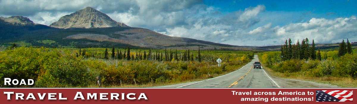
Antelope Canyon, Horseshoe Bend and Glen Canyon Travel
| Glen Canyon Dam & Lake Powell |
| Antelope Canyon |
| Horseshoe Bend |
| Hotel and Restaurants |
The City of Page is located in extreme northern Arizona near Utah. At an elevation of 4,300 feet atop Manson Mesa and overlooking Wahweap Bay of Lake Powell, Page has become a major resort area.
Location
Page is located 5.5 hours north of Phoenix, and 2.5 hours north of Flagstaff. It is the center of the world-renowned Grand Circle - a remarkable collection of parks, monuments, historical sites, and prehistoric Indian ruins. Page is surrounded by geological formations that are iconic in the American West.
The Grand Circle is a beautiful, vast region encompassing portions of five states: Arizona, New Mexico, Colorado, Utah and Nevada. It contains America’s largest concentration of national parks and monuments, woven together by extraordinary designated Scenic Byways.
Page is just a 2-3 hour drive from several popular parks:
- Grand Canyon National Park (South Rim) - 130 miles
- Bryce Canyon National Park - 150 miles
- Zion National Park - 105 miles
- Monument Valley Navajo Tribal Park - 125 miles
History
The city was planned and developed in 1957 to house the workers building the Glen Canyon Dam. In 1958, some 24 square miles of Navajo land were exchanged for a larger tract in Utah, and "Government Camp" (later called Page in honor of Bureau of Reclamation Commissioner John C. Page) was born. The City of Page was incorporated in March of 1975.
Page Today in 2026
Page has emerged as a self-sufficient and progressive city. Lake Powell, the Navajo Generating Station, and tourism are the major contributors to the economy. The city is a popular home base for hiking, biking, boating, and off-road adventure.
The Page Municipal Airport has a lighted 5,500-foot paved runway and offers flights to and from Phoenix and Denver. Charter service and tours are also available.
We have visited Page on multiple road trips, and and have enjoyed the many sights and attractions in the city, and surrounding natural areas.
Spend a day, ideally many more, and enjoy and explore the beauty and attractions of the city!
| The Glen Canyon National Recreation Area (Staff Photo) |
 |
Map of the Page Area in Northern Arizona
Hotel and Restaurant Options in Page
Boasting a wide variety of accommodations, Page makes it easy for visitors to find the ideal place to rest after a long day of hiking or boating. Lodging spans from a family run bed and breakfast or motel, to national/international hotel chains. RV parks, camping facilities and houseboat rentals are also available.
There are about 40 lodging facilities with roughly 3,000 rooms in Page, not including RV parks and camping.
Page has an extensive variety of dining and culinary options available. Cuisines include classic American, Southwestern, Italian, Mexican, Asian, and a fast food outlets.
Antelope Canyon
There are 7 different slot canyons available for tours on the Navajo Nation, all within minutes of downtown Page.
One of the more popular is Antelope Canyon, just east of Page on State Highway 98. It includes two separate, scenic slot canyon sections, referred to as Upper Antelope Canyon (or The Crack), and Lower Antelope Canyon (or The Corkscrew).
The canyons are a popular location for photographers and sightseers, and a source of tourism business for the Navajo Nation. It has been accessible by tour only since 1997, when the Navajo Tribe made it a Navajo Tribal Park.
Few geological formations are as picturesque and awe-inspiring as Antelope Canyon. With tall winding walls, it’s a monumental sandstone sculpture. A photographer’s dream, the canyon is known for its wave-like structure and the light beams that shine directly down into the openings of the canyon, creating a supernatural appearance.
All areas of the Antelope Canyon are only accessible via guided tour. Tour guides are mandatory.
For more information, visit Antelope Canyon at DiscoverNavajo.com or phone the Antelope Canyon Tribal Park at 928.698.2808.
 |
Upper Antelope CanyonThis canyon is the most frequently visited by tourists because its entrance and entire length are at ground level, requiring no climbing. |
| Aerial view of the entrance area at Upper Antelope Canyon |
 |
Lower Antelope CanyonThis area is located several miles from Upper Antelope Canyon. Prior to the installation of metal stairways, visiting the canyon required climbing pre-installed ladders in certain areas. |
Even following the installation of stairways, it is a more difficult hike than Upper Antelope. It is longer, narrower in places, and even footing is not available in all areas. Five flights of stairs of varying widths are currently available to aid in descent and ascent.
|

Horseshoe Bend
Horseshoe Bend is a horseshoe-shaped incised meander of the Colorado River, located about 4 miles south of Page on U.S. Highway 89. The hike from the parking lot to the overlook is about .6 miles one-way. From the overlook, the canyon wall drops about 1,000 feet down to the Colorado River.
In 2018, a fenced overlook area was created for viewing safety. However, visitors who want to venture away from the fenced partition are asked to exercise caution; the sandstone edges of the terrain can be unstable causing slides or breaks underfoot.
Horseshoe Bend is open year-round from dawn to dusk. The busiest times of the day are between 9:00am to 11:00am in the morning and 4:30pm to 6:30pm in the evening. If you enjoy fewer crowds, try scheduling your hike around these busy times. There is no overnight parking or camping allowed.
Entrance fees are charged.
Glen Canyon Dam and Lake Powell
Glen Canyon Dam, rising 710 feet above bedrock within the steep, rust-colored sand-stone walls of Glen Canyon, was constructed to harness the power of the Colorado River in order to provide for the water and power needs of millions of people in the West.
 Parking area outside the Carl Hayden Visitor Center Parking area outside the Carl Hayden Visitor Center |
The dam is the second highest concrete-arch dam in the United States, second only to Hoover Dam. The 26.2 million acre-feet of water storage capacity in Lake Powell, created by Glen Canyon Dam, serves as a 'bank account" of water that is drawn on in times of drought. This stored water has made it possible to successfully weather extended dry periods by sustaining the needs of cities, industries, and agriculture throughout the West.
The Carl B. Hayden Visitor Center is located 700 feet above the Colorado River overlooking the Glen Canyon Dam and Bridge. The visitor center provides many interesting exhibits, audio-visual programs, and ranger presentations as well as a gift shop and an educational bookstore. Guided tours of Glen Canyon Dam and powerplant are provided by the Glen Canyon Conservancy, and begin at the visitor center. Admission to the visitor center is free, as is parking.
Lake Powell has 1,900 miles of shoreline, and is over 186 miles long. The shoreline can be explored by houseboat, power boat, kayak, or personal water craft. There are 96 major canyons to explore as well as Rainbow Bridge National Monument that can be reached via watercraft.
Encompassing over 1.25 million acres, Glen Canyon National Recreation Area offers unparalleled opportunities for water-based & backcountry recreation. The recreation area stretches for hundreds of miles from Lees Ferry in Arizona to the Orange Cliffs of southern Utah, encompassing scenic vistas, geologic wonders, and a vast panorama of human history.
| View of Lake Powell from the Carl Hayden Visitor Center (Staff Photo) |
 |
| The Glen Canyon Dam Bridge over the Colorado River, looking east from the Carl Hayden Visitor Center (Staff Photo) |
 |
| Some of the displays and kiosks inside the Carl Hayden Visitor Center |
 |
| The Glen Canyon Dam Bridge, looking west towards the Carl Hayden Visitor Center (Staff Photo) |
 |
| The expanse of beautiful Lake Powell (Staff Photo) |
 |
More Information and Resources about Page & Northern Arizona |
|