Driving the Turquoise Trail in New Mexico
 |
For many years as we were planning our next road trip, we always wondered "Where is the Turquoise Trail" that we keep hearing about!
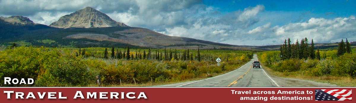
The Turquoise Trail is officially New Mexico Highway 14, and is designated a Scenic Byway. It stretches about 63 miles from Santa Fe down to Tijeras near Interstate 40. Driving time is about 1:35 nonstop ... but who would want to drive this interesting route from end to end without stopping, with so much to see and do in between?
On one of our first trips to Santa Fe we discovered the Turquoise Trail, and drove it from Santa Fe southward to Tijeras, and headed westbound through Albuquerque to drive on Historic U.S. Route 66 to Gallup and into Arizona.
We have since driven the trail several times, from north to south, and south to north, stopping many times along the way to shop, dine or have photo ops. Traffic is never a problem, and it is a peaceful drive through rugged New Mexico countryside.
Tourists encounter several interesting small towns and communities along the way, filled with shops and dining opportunities. Begining our trip in Santa Fe on Cerrillos Road, and heading south, the trail travels through Los Cerrillos, Madrid, Golden, and San Antonito and ends near Tijeras.
Spend a day, or more, and enjoy and explore the Turquoise Trail in 2026!
Map of the Turquoise Trail from Santa Fe to Tijeras
| Map showing the location of the Turquoise Trail in New Mexico from Santa Fe to Tijeras |
 |
Los Cerrillos, New Mexico
Cerrillos, Spanish for "Little Hills", began in the 1870s as a bustling gold and silver mining town. Today, it is now a quiet, tree-lined village with a population of 200, located 20 miles south of Santa Fe on the Turquoise Trail..
Historic adobe and western buildings line the dirt streets, including a bar and grocery, old opera house and St. Joseph's Church. Visitors enjoy the Mining Museum, Cerrillos Cultural Center and Petting Zoo. Be sure to take the self-guided walking tour around the village where signs are posted on many of the buildings, revealing the rich history of Cerrillos.
Read more about this community at CerrillosNewMexico.com
What Not Shop in Cerrillos |
Mary's Bar in Cerrillos |
Cerrillos Hills State park
Another popular outdoor destination in the area is Cerrillos Hills State Park with its hiking, biking and riding trails. It is a year-round, day-use park located off the Turquoise. Visitors cross paths with over 1,100 years of mining history here along the five miles of trails and enjoy spectacular views of the Sandia, Ortiz, Jemez, and Sangre de Cristo mountain ranges.
The entrance to the Visitor's Center is off of Rail Road, just south and west of the railroad crossing. Park brochures, maps & New Mexico State Park information can be found in the lobby and outside under the front portal. A gift shop which has snacks, local books, hats, minerals & greeting cards.
The park has five miles of trails which offer scenic views of the Galisteo Basin and surrounding areas. Historic mine shafts are safeguarded and signed with interpretive information. Elevations range from 5,800-6,100 feet.
For more information visit this website ... Cerrillos Hills State Park
| Scenic Historical Marker at Los Cerrillos, New Mexico ... Elevation 5,688 feet |
 |
Madrid, New Mexico
The village of Madrid lies in a narrow canyon in the Ortiz Mountains, along the Turquoise Trail. It originated as a coal mining town in the mid-1850s, and later became a ghost town.
Today, Madrid is an active, creative community with over 40 shops and galleries, several restaurants, a spa and museum. In addition to its busy main street filled with merchants and artisans, it also features a quiet residential area.
Don't miss the historic Mine Shaft Tavern "roadhouse" with live music every weekend and the "ghost town" museum.
Read more about Madrid at ... VisitMadridNM.com
Golden
About 10 miles south of Madrid on the Turquoise Trail is the community of Golden, formed in 1879. Golden was selected as the center of the new gold-mining district and soon grew to support several saloons, businesses, a school, and even a stock exchange. In 1880, the post office was opened.
Today, the community is small, with few inhabitants. Golden's most photographed building is the San Francisco Catholic Church, which was restored by historian and author, Fray Angelico Chavez, in 1960, while he was the padre of the St Joseph Church in Los Cerrillos. Across the highway, west of the church, are the ruins of another large structure, as well as mining remnants.
Sandia Crest National Scenic Byway
The Sandia Mountains are a small range east of Albuquerque, with its high point being a long ridge called the Sandia Crest at an elevation of 10,678 feet. Albuquerque lies about 4,500 feet below the Crest.
Access to the Crest from the Turquoise Trail is via NM Highway 536, the Sandia Crest National Scenic Byway. This paved road has many switchbacks and offers stunning views of the area countryside. The highway ends at the Sandia Crest which has a restaurant, gift shop, handicap accessible viewing, and toilets.
The Sandia Peak Aerial Tramway begins in northeast Albuquerque and travels to the crestline of the Sandia Mountains. It is the longest aerial tram in the United States. For more information, visit the website of the Sandia Peak Aerial Tramway
Interactive Map of the Turquoise Trail Area
More Information about the Turquoise Trail
Turquoise Trail Scenic Byway on NewMexico.org
Turquoise Trail Scenic Byway at VisitAlbuquerque.org