Dalton Highway in Alaska
Location
 Sign for Alaska Highway 11 ... the James Dalton Highway |
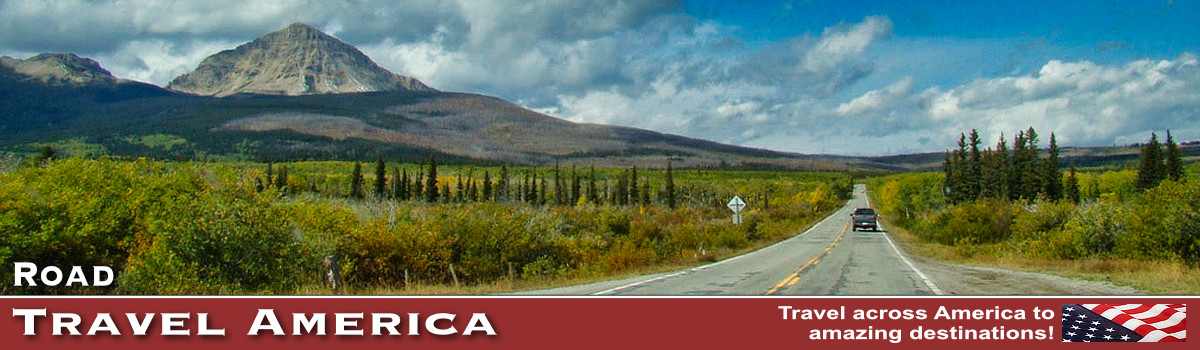
The James W. Dalton Highway is a rough, industrial road that begins 84 miles (134 km) north of Fairbanks and ends 414 miles (662 km) later in Deadhorse, the industrial camp at Prudhoe Bay.
The highway, which parallels the Alaska Pipeline, is one of the most isolated roads in the United States. There are only three towns along the route:
- Coldfoot (pop 10) at Mile 175
- Wiseman (pop 22) at Mile 188
- Deadhorse (25 permanent residents, plus a few thousand seasonal residents depending on oil production) at the end of the highway at Mile 414.
First: The Haul Road ... Then the James W. Dalton Highway
Initially, the highway was called the Haul Road because almost everything supporting pipeline construction and oil development was hauled on tractor-trailer rigs to its final destination. The Haul Road was completed in just five months and the pipeline in three years (1974-77).
In 1981, the State of Alaska named the highway after James W. Dalton, a lifelong Alaskan and expert in arctic engineering who was involved in early oil exploration efforts on the North Slope. It is numbered as Alaska Highway 11.
The highway was open only to commercial traffic until 1981, when the state allowed public access to Disaster Creek at Milepost 211. In 1994, public access was allowed all the way to Deadhorse for the first time.
The highway is the featured road on the third, fourth, fifth and sixth seasons of the History reality television series Ice Road Truckers.
 |
The James W. Dalton Highway  |
Driving the Road
Interactive Google Map of the Dalton Highway |
Today, the Dalton Highway remains a key element in support of Prudhoe Bay oil operations. But it also beckons adventurous tourists to explore a still-wild and mysterious frontier.
It provides a rare opportunity to traverse a remote, unpopulated part of Alaska to the very top of the continent. However, traveling this farthest-north road involves real risks and challenges.
The highway comes to within a few miles of the Arctic Ocean. Beyond the highway's terminus at Deadhorse are private roads owned by oil companies, which are restricted to authorized vehicles only. There are, however, commercial tours that take visitors to the Arctic Ocean.
All vehicles must take extreme precaution when driving on the road, and drive with headlights on at all times. There are quite a few steep grades (up to 12%) along the route, as well. There are no medical facilities between Fairbanks and Deadhorse, a distance of 500 miles.
Food, gas, and vehicle repair services are extremely limited.
Not all rental car companies allow travel on gravel roads, so check in advance if you plan on renting a vehicle for this adventure. Also, cell service is limited along the Dalton Highway. Be sure to bring extra gas and perhaps an extra spare tire just in case.
Summers on the Dalton
Summer temperatures can occasionally reach the high 80s F south of the Brooks Range and average in the 50s F in Coldfoot. Thunderstorms are common in early summer, especially between Fairbanks and the Yukon River, and may bring lightning and sudden squalls.
In general, June and July are drier months, but rainy days are frequent throughout the summer. Weather on the North Slope is frequently windy, foggy, and cold. Snow can occur at any time of the year, especially from the Brooks Range north. In Deadhorse, average summer temperatures are in the 30s and 40s F.
Winter Travel
 The Alaska Pipeline ... running parallel to the Dalton Highway |
The coldest temperature ever recorded in the United States was -80F/-62C at Prospect Camp, 39 miles south of Coldfoot in 1971. On January 28, 2012, an unofficial temperature of -79F/-62C was recorded at nearby Jim River Maintenance Station. Then the weather station battery died.
Does the highway close in the winter? No. The road remains open for trucks hauling supplies to the oil fields and camps. Although the highway is maintained year-round, in winter services of any kind are only available in Coldfoot (MP 175) and Deadhorse (MP 414). Winter driving conditions are extremely hazardous. Drivers face snow, ice, wind, whiteouts, and dangerous cold with windchills to -70F (-5.C).
Winter travel should be done in a vehicle equipped for extreme cold weather conditions and proper tires. Winter driving experience is essential.
| An icy stretch of the James Dalton Highway |
 |
Road Characteristics and Conditions
The road is narrow, has soft shoulders, high embankments,and steep hills. There are lengthy stretches of gravel surface with sharp rocks, potholes, washboard, and, depending on the weather, clouds of dust or slick mud. Watch out for dangerous curves and loose gravel, especially between Livengood and the Yukon River (MP 0-56).
You may encounter snow and ice north of Coldfoot any month of the year. Expect and prepare for all conditions. Road construction occurs in various areas and can cause some delay. The Dalton Highway is paved from Milepost 37 to 49 and from Milepost 90 to 197 (Gold Creek). Beyond that there is pavement (with breaks) from Milepost 335 (Happy Valley airstrip) to 362.
 Yukon River - 56 miles ... Deadhorse - 414 miles |
Time to Drive
How long does it take to make the trip? Driving times depend on weather, road conditions, road construction, and the interests of the traveler. The round trip to Prudhoe Bay and back takes at least four days. Under good conditions, expect the following driving times from Fairbanks to:
- Yukon River - 3 hours
- Arctic Circle - 5 hours
- Coldfoot - 6 hours
- Atigun Pass - 8 hours
- Deadhorse - 13+ hours
Factor in an additional 1-2 hours per day for rest stops, wildlife viewing, construction delays, and bad weather.
The Arctic Circle
The Arctic Circle is an imaginary line encircling the Earth at latitude 66.33 North where the sun does not set on summer solstice (June 20 or 21) or rise on winter solstice (December 21 or 22).
As you travel farther north there are more days with 24-hour sunlight in summer or 24-hour night in winter. At the top of the world the North Pole the sun doesn't set for 180 days.
At the Arctic Circle, the midnight sun circles the northern horizon and drops behind the Brooks Range. The closest view is from the hill above Gobblers Knob at MP 132, 17 miles/27 km farther north. If you travel north of Atigun Pass (MP 245) you can experience the full 24 hours of sunlight.
| The Arctic Circle on the Dalton Highway in Alaska ... Latitude 66.33' |
 |
Wildlife Along the Dalton
The boreal forest is the largest forest ecosystem in the world, encircling the entire northern hemisphere. A cold, dry climate and areas of permanently frozen ground dictate what grows here. Scraggly spruce trees may be more than a century old. Wildfires recycle nutrients into the soil and create new sources of food and shelter for wildlife. Here you will see few animals unless they cross the road. The forest hides moose, wolf, fox, black bear, snowshoe hare, lynx, and over 50 species of songbirds. Beaver, muskrat, and mink may be glimpsed in streams and ponds along with Pacific loon, horned grebe, widgeon, scaup, and northern shoveler.
You may encounter bears anywhere along the Dalton Highway. Both black and grizzly bears are found south of the Brooks Range, and grizzlies roam all the way to the Arctic Ocean. All bears are potentially dangerous. It is illegal to feed wildlife or leave food where they can get it. Food-conditioned bears become a threat to people and frequently must be destroyed.
Wolves may approach people along the Dalton. In 2006, two people were chased and one was bitten. Some incidents appear to involve food-conditioned wolves. Never approach or feed wolves!
Besides the boreal forest, the highway passes through high alpine, and rolling tundra areas, each with their own native wildlife species.
Scenes Along the Highway
| Welcome to the James Dalton Highway ...Gateway to the Arctic .... the Road to Prudhoe Bay |
 |
| Sukakpak Mountain on the Dalton Highway (BLM Photo) |
 |
| Truckers at work on the Dalton Highway |
|
 |
 |
Welcome Everyone to Sourdough Fuel in Coldfoot, Alaska ... "Your warm friends since 1898"  |
Recreation Along the Dalton
Visitors to the area enjoy camping, hiking, rafting, canoeing, backpacking, panning for gold, hunting (in some areas), fishing, the northern lights and birdwatching.
Various activities are available at popular parks, national recreational areas and wildlife refuges.
Arctic Interagency Visitor Center
|
|
Map of the Dalton HighwayShown to the left is a map of the James Dalton Highway, courtesy of the Bureau of Land Management (BLM). The map features attractions, overlooks, wildlife refuges, trailheads, mile markers, streams & rivers, restrooms, gas stations, lodging, camping and other points of interest to travelers. click the image to view the PDF map & details at the BLM website |
|


| The Dalton Highway at Mile 256 north of the Continental Divide in the Brooks Range (NPS) |
 |
Coldfoot, Alaska
| Coldfoot Camp along the Dalton Highway ... 55 miles north of the Arctic Circle on the east bank of the middle fork Koyukuk River |
 |
| Another cold day in Coldfoot, Alaska |
 |
Wiseman, AlaskaLocated just three miles off the Dalton Highway and near the boundary of Gates of the Arctic National Park and Preserve, Wiseman is a jumping-off point for properly equipped backpackers who want to trek into the park on foot. Less than two-dozen people live in Wiseman, a century-old mining town that enjoyed its heyday in the 1920s. Thirty cabins from the gold rush era are still used today, mostly by seasonal residents. It can get cold here in the winter; easily dropping to minus 70 degrees Fahrenheit. Wiseman's scenic settling along the Middle Fork of the Koyukuk River and against the backdrop of the Brooks Range give you a sense for its recreational options. Hiking, fishing, river rafting or float trips, bird watching and wildlife viewing are excellent in summer. In winter, cross-country skiing, snowshoeing, dog mushing and most notably, northern lights viewing, are excellent.
|

Deadhorse, AlaskaLocated at the northernmost reaches of the U.S. road system, Deadhorse and Prudhoe Bay sit on the coast of the Arctic Ocean at the heart of Alaska’s oil patch. The town of Deadhorse consists primarily of facilities for the workers and companies that operate at the nearby Prudhoe Bay Oil Field. Most buildings are modular, pre-fabricated types, situated on gravel pads on tundra bog. Virtually all the businesses are engaged in oil field or pipeline support such as drilling, construction and maintenance. Deadhorse is located at the end of the Dalton Highway, from 495 mi north of Fairbanks. It is also accessible via the Deadhorse Airport. Limited accommodation is also available for tourists. Access to Prudhoe Bay and the Arctic Ocean is restricted to oilfield workers and tour groups with special permits.
|

The Dalton Highway on TripAdvisor: reviews, lodging, dining, photos Coldfoot, Alaska on TripAdvisor: lodging, restaurants, things to do
Where to Stay: Fairbanks area hotels and lodging - Reviews and Photos |
Dalton Highway Survivor ... the End of Alaska 11, at Deadhorse, Alaska |


More Popular Alaska Destinations |
|||
 |
 |
 |
 |
 |
 |
 |
 |
More Information about the James Dalton Highway
Dalton Highway - Visitor Guide at the Bureau of Land Management (PDF)
Dalton Highway - Alaska Department of Transportation & Public Facilities
Dalton Highway - TravelAlaska.com
Arctic Interagency Visitor Center
The Dalton Highway on TripAdvisor: reviews, lodging, dining, photos