Wrangell-St. Elias National Park & Preserve
Location and Size
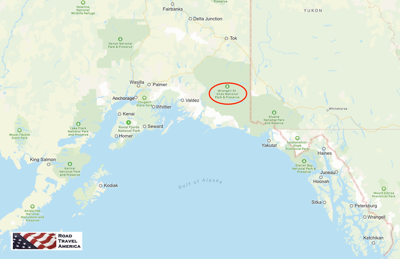
The Wrangell-St. Elias National Park and Preserve is located in south central Alaska, and is the largest area managed by the National Park Service (NPS), with a total of 13,175,799 acres (20,587sq mi). The park is the same size as Yellowstone National Park, Yosemite National Park, and Switzerland combined!
Designated as a national park in 1980, Wrangell-St. Elias abuts against Canada's Kluane National Park, and together their 20 million acres represent one of the largest wilderness areas left in the world. For this reason, the two parks were recognized by the United Nations as a World Heritage site in 1979.
| Wrangell-St. Elias National Park P.O. Box 439 Mile 106.8 Richardson Highway Copper Center, AK 99573 Phone 907.822.5234 Website of Wrangell-St. Elias National Park at NPS |
The park approaches Glacier Bay National Park and Preserve to the south.
The Mountains and Volcanoes
The park includes a large portion of the Saint Elias Mountains, which include most of the highest peaks in the United States and Canada, yet are within 10 miles of tidewater, one of the highest reliefs in the world.
The Wrangell and St. Elias Ranges contain some of the largest volcanoes and greatest concentration of glaciers in North America. Nine of the 16 highest peaks on U.S. soil are located in the park.
The park's extreme high point is Mount Saint Elias at 18,008 feet (5,489 m), the second tallest mountain in both the United States and Canada. The park has been shaped by the competing forces of volcanism and glaciation. Mount Wrangell is an active volcano, one of several volcanoes in the western Wrangell Mountains.
The Glaciers and Icefields
Within Wrangell - St. Elias National Park is the largest glacial system in the United States, covering nearly 35% of the park’s land.
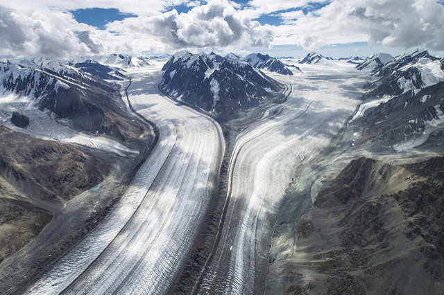
The park's glacial features include Malaspina Glacier, the largest piedmont glacier in North America, Hubbard Glacier, the longest tidewater glacier in Alaska, and Nabesna Glacier, the world's longest valley glacier. The Bagley Icefield covers much of the park's interior.
The Hubbard Glacier is immense in size, at 76 miles long, seven miles wide, and 600 feet tall. While the vast majority of glaciers across North America are shrinking, Hubbard is actually growing.
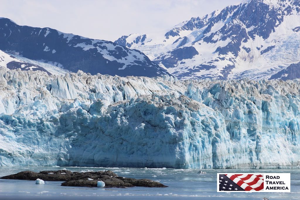 The Hubbard Glacier |
Hubbard Glacier slides into Yakutat Bay and into the Gulf of Alaska. Read more about Yakutat, Alaska and the Hubbard Glacier.
Kennecott Mining Company
In the early 1900s the Kennecott Mining Company transported copper from its mines near McCarthy by railroad along the Chitina and Copper rivers to ships at Cordova. Ore was extracted from these productive mines between 1911 and 1938 and lured many people to the area. Gold was extracted from the Nabesna area, then too. Mining still takes place on private lands in the park, and evidence of earlier mining includes ruins of the Kennecott mines, now listed on the National Register of Historic Places.
Copper River
The Copper River flows along the western margin of the park, and has its headwaters within the park at the Copper Glacier.
Let's Visit the Park!
Spend a day, or more, and enjoy and explore Wrangell-St. Elias National Park!
| Map showing the location of Wrangell-St. Elias National Park relative to other Alaska cities, parks and preserves |
 |
Welcome to Wrangell-St. Elias! 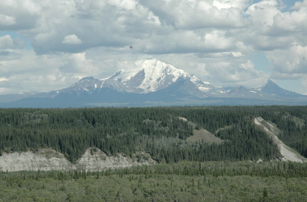 |
Scenes from Around the Park
| Convergence of the Baldwin and Fraser Glaciers at Wrangell-St. Elias National Park in Alaska (NPS Photo) |
 |
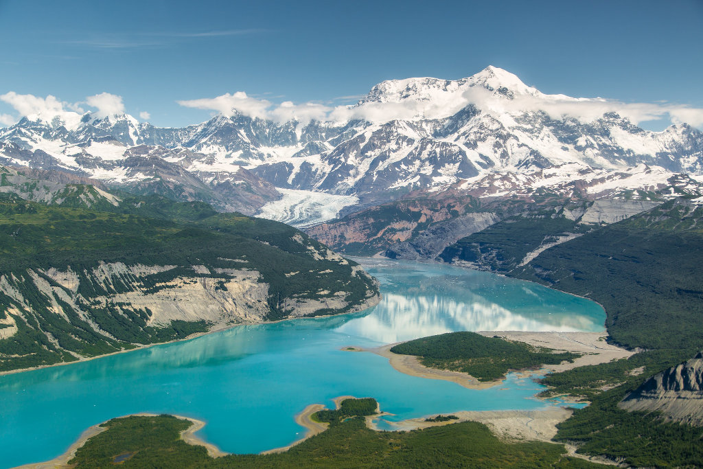
| Icy Bay at Wrangell-St. Elias National Park and Preserve in Alaska (NPS) |
 |
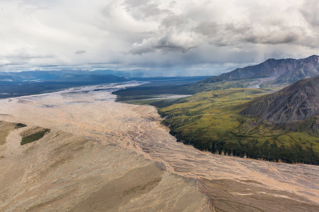
| Aerial view of the White River at Wrangell-St. Elias National Park (NPS) |
 |
Entrance sign at Wrangell-St. Elias NP
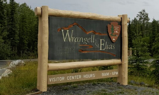 |
Fishwheel display at the visitor center 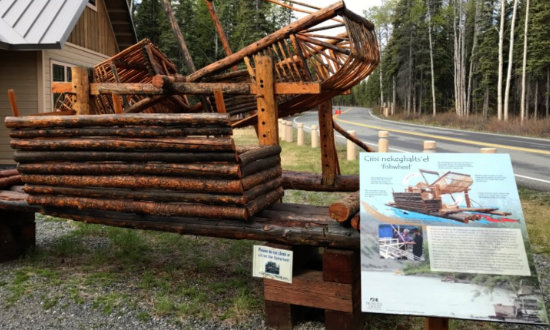 |
Copper Center Visitor Center
Copper Center visitor center details at the NPS website or phone 907.822.5234
|
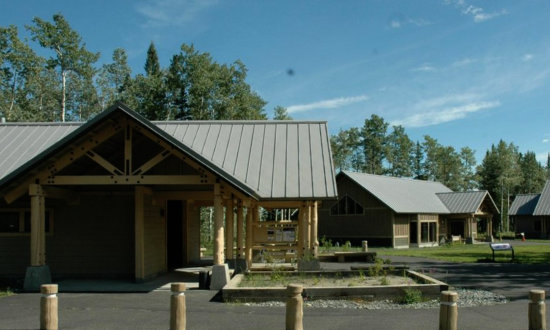
Located 10 miles south from the intersection of the Glenn Highway and the Richardson Highway, the Copper Center Visitor Center Complex is the best place to begin a visit to the park.
The complex includes a visitor center, a bookstore, an exhibit hall, a theater, restrooms, picnic tables and a picnic shelter, an amphitheater, scenic overlooks and short hiking trails. Also, the park administration and business offices are located nearby.
The Ahtna Cultural Center is located next to the Visitor Center and is operated by the Ahtna Heritage Foundation. There are exhibits, a hand-built fish wheel on display, and museum staff available to answer questions. For more information, visit the Ahtna Heritage Foundation.
In addition to the Copper Center visitor center, the park maintains a visitor center at Kennecott and an information station at Mile 59 on the McCarthy Road. There are ranger stations at Slana on the Nabesna Road, in Chitina at the end of the Edgerton Highway, and in Yakutat.
Chitina Ranger Station
The Chitina Ranger Station is located at the end of the paved Edgerton Highway and the beginning of the gravel McCarthy Road, one of only two roads into Wrangell - St. Elias National Park and Preserve.
Inside the Chitina Ranger Station (NPS)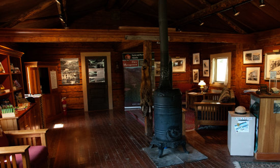 |
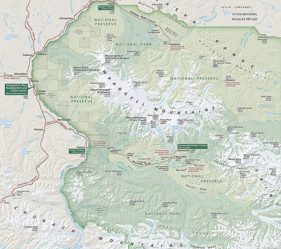
Map of Wrangell-St. EliasShown below is a map of Wrangell-St. Elias National Park, courtesy of the National Park Service. click the image to view maps at NPS |
| Peaceful lake with snow-capped mountains in the distance ... at Wrangell-St. Elias National Park |
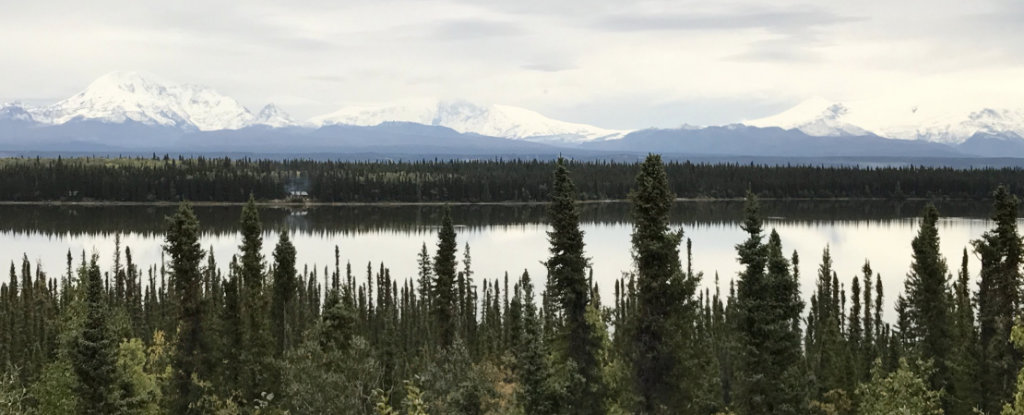 |
Getting To and Around in the Park
The park is accessible by highway from Anchorage; two rough gravel roads (the McCarthy Road and the Nabesna Road) wind through the park which makes portions of the interior accessible for backcountry camping and hiking. Chartered aircraft also fly into the park.
The park area includes a few small settlements. Nabesna and Chisana are in the northern part of the park. Kennicott and McCarthy are relatively close together in the center of the park, with a few smaller settlements nearby and along the 60-mile (97 km) McCarthy Road. Chitina serves as a gateway community where the McCarthy Road meets the Edgerton Highway along the Copper River.
Access to the park is open all year, and most of the park facilities are open from May to September, although some locations open as late as the end of May and close in mid-August. The main visitor center remains open on weekdays in the winter. The abandoned mining town of Kennecott can be accessed by footbridge from a continuation of the McCarthy road.
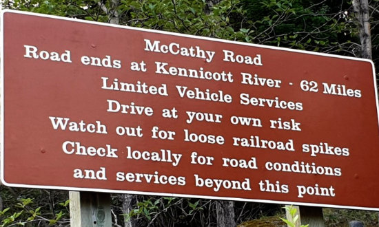 |
There are only two roads that enter the park: The Nabesna Road and the McCarthy Road. Both are gravel roads that are owned and maintained by the state of Alaska, not the National Park Service. Both roads are usually passable to all vehicles during the summer months.
The McCarthy Road
The 60-mile McCarthy road follows the old Copper River and Northwestern Railroad route. Although traffic and weather often result in potholes and washboarded surfaces, under normal summer conditions most passenger vehicles can make the trip.
The McCarthy Road winds deep into the heart of Wrangell-St. Elias National Park and Preserve. Today's road originated in 1909 as a railway constructed to support the Kennecott Copper Mines. When large scale mining ended in 1938, most of the rails were salvaged for scrap iron. In 1971 a new bridge was constructed over the Copper River and the rail bed was covered with gravel, creating today's surface of the McCarthy Road.
Narrow and winding, the road still reflects its railway origins. The road ends at the Kennicott River, a half-mile short of McCarthy and five miles short of historic Kennecott.
Nabesna Road
The Nabesna Road offers an opportunity to explore the northern reaches of the park. The drive is an adventure with views of the Wrangell, Mentasta, and Nutzotin Mountains. Along the way travelers find campsites, scenic vistas, hiking routes, and opportunities for wildlife viewing. It begins at mile 60 of the Glenn Highway in Slana, Alaska.
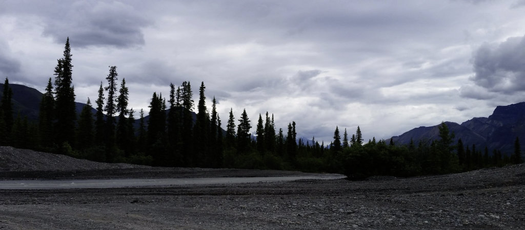
The road is 42 miles long, unpaved, with rough conditions and washouts at creek crossings. To safely navigate the road, a high-clearance vehicle with 4-wheel drive is recommended.
| Creek crossing on the Nabesna Road in Wrangell-St. Elias National Park |
 |
What Weather to Expect in Wrangell-St. Elias
The park has long, extremely cold winters and a short summer season. Weather can change quickly.
Although the park contains some coastline, high mountains and icefields act as barriers to the ocean's moderating influence. The result is that with the exception of the coastal Yakutat area, Wrangell-St. Elias has an interior continental climate (long, extremely cold winters, and short, warm, relatively dry summers).
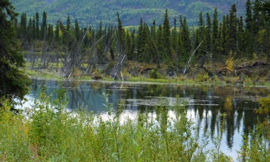
Wildflowers and mosquitoes peak in June and July. Consider bringing a head-net. June and July are also the warmest months, with highs reaching near 80 on some days, but it can snow any month of the year in the highcountry.
Autumn arrives early; willows and aspens begin to change color by mid-August. This season can be delightfully clear, spectacular, and mosquito-free, but it often too short. First snows often fall in September.
The winter season is long, dark, and extremely cold with highs of 5-7F and nighttime lows dipping to -50F! Temperatures may remain below freezing for five months. Daytime skies are usually clear and at night the aurora dances overhead. Exceptionally dry snow covers the ground to around two feet.
In the spring, clear skies, increasingly longer days, and warming temperatures break winter's hold on the land with dramatic quickness. Average highs are 40-50. Lows may still dip into the teens and single digits.
Summer at Wrangell-St. Elias NP
 |
Autumn at Wrangell-St. Elias NP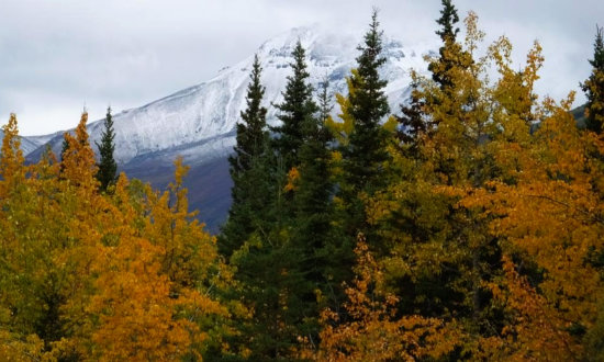 |
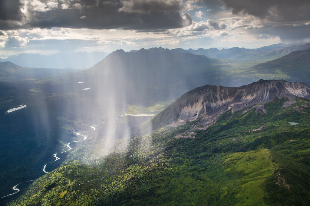
| Rainfall over the lush green valleys of the Wrangell Mountains in Alaska (NPS) |
 |
Activities and Lodging in/near Wrangell-St. Elias
There is so much to do in the park! Visitors enjoy hiking, backpacking, guided tours/demonstrations by park rangers, mountaineering, floating & boating, sport hunting & fishing, wildlife viewing, birding, horseback riding, motorized recreation and various winter activities.
There are many options for lodging within Wrangell - St. Elias including campsites, hotels, motels, RV sites, and bed and breakfasts. Another popular lodging option are the park's 14 backcountry cabins that are available for public use. Many of these cabins were built by hunters, trappers or miners long ago, but have since come under the National Park Service’s administration. All but one of these cabins are available free of charge, and just four require reservations; the other ten are available on a first-come, first-served basis, and many require a bush flight to get there.
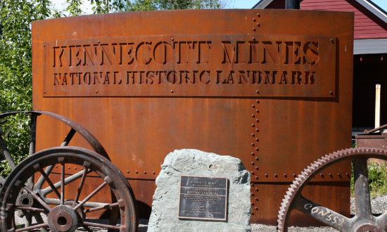
Kennecott Mines National Historic Landmark
 |
The buildings of Kennecott Mines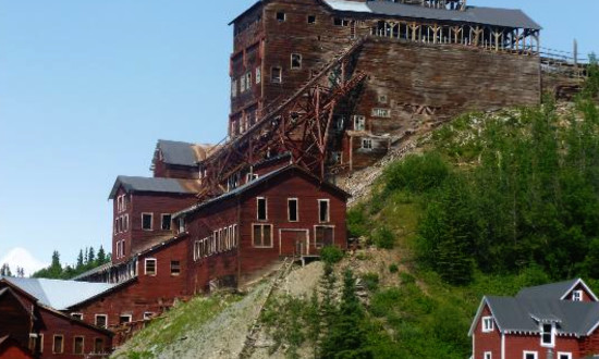 |
Other Popular Alaska Parks & Destinations |
|||
 |
 |
 |
 |
More Information about Wrangell-St. Elias
Website of Wrangell-St. Elias National Park & Preserve at NPS
Wrangell-St. Elias National Park & Preserve on Facebook
TravelAlaska.com - Wrangell-St. Elias National Park
U.S. Department of the Interior - Things You Did Not Know about Wrangell-St. Elias National Park
Copper Valley Chamber of Commerce - lodging, dining and other info
Wrangell-St. Elias National Park Travel Guide ... TripAdvisor reviews, photos, lodging, dining
