Black Canyon of the Gunnison National Park
Location and Characteristics
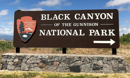
The Black Canyon of the Gunnison National Park is located in western Colorado. The park lies 7 miles north on CO Highway 347 from the intersection with U.S. Highway 50, east of Montrose.
 |
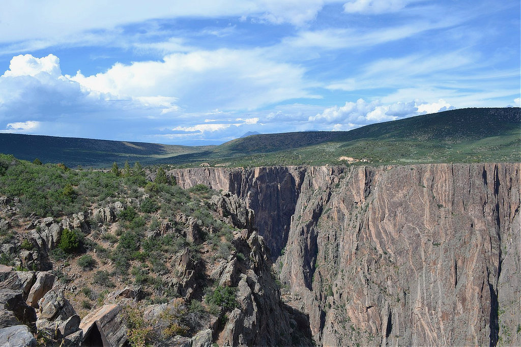
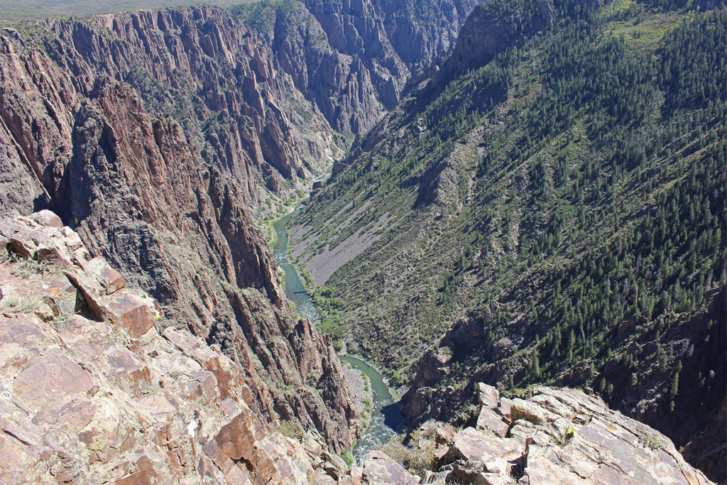
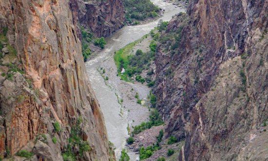
It preserves 12 miles of the narrowest and deepest section of the Gunnison River gorge. The park is named for its cliffs that are often darkened by shadows, making the walls of the gorge appear black.
The total length of the canyon is 53 miles, upstream from the Curecanti National Recreation Area and downstream from the Gunnison Gorge National Conservation Area.
At the top of the gorge, the distance from the South Rim to the North Rim is as little as only 1,100 feet. The walls of the canyon plunge 2,000 feet down. At the river, the canyon is as narrow as only 40 feet.
The Black Canyon supports a large variety of animal life, including bobcats, foxes, mule deer, coyotes, rock squirrels, and a wide variety of birds, including the golden and bald eagles.
The area was designated a National Monument in 1933, and redesignated as a National Park in 1999.
It is the least visited of the four National Parks in Colorado, and is one of the smallest parks in the USA, both factors which make a visit to the park an easy, and pleasant, one!
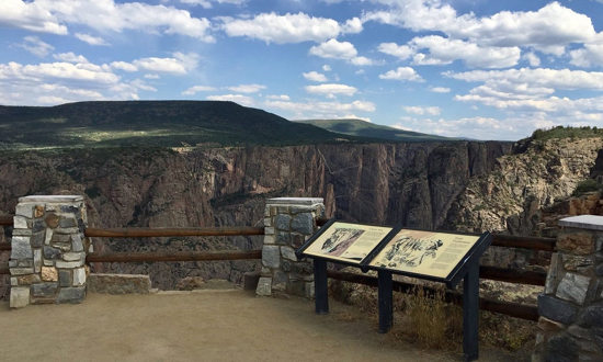
| The rim of the Black Canyon of the Gunnison National Park |
 |
Visitor Center
| Black Canyon of the Gunnison National Park 9800 Highway 347 Montrose, CO 81401 Phone 970.641.2337 Website of Black Canyon of the Gunnison NP at NPS |
The park is open 24 hours a day, every day, and no entry reservation is needed. The park’s South Rim Visitors Center is open year-round and is a great starting point for any visit to the park.
The visitor center is staffed with rangers and has exhibits, a film about the park, and a bookstore.
Three hiking trails and Gunnison Point Overlook may be accessed from the visitor center. Maps, newspapers, junior ranger books, weather updates, and wilderness permits are available within the visitor center.
There is a self-registration kiosk for wilderness permits when the visitor center is closed. The visitor center has car parking and some trailer/ RV parking. In the summer, the parking lot often fills.
The South Rim Road is open to vehicles from early April to mid-November. In winter, the South Rim Road is open to Gunnison Point.
The remainder of the road is closed to vehicles, but open to cross country skiing and snowshoeing.
The North Rim ranger station is open intermittently during the summer.
Visitor Center at the Black Canyon of the Gunnison National Park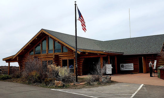 |
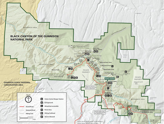
Map of the Black Canyon of the Gunnison National ParkShown below is a map of the Black Canyon of the Gunnison National Park, courtesy of the National Park Service. click the image to view Colorado Monument maps at NPS |
Driving the South Rim Road
The South Rim Road is 7 miles long and features 12 viewpoints, or overlooks. It starts at Tomichi Point, before the visitor center, and ends at High Point. The trails to overlooks vary in length, some up to a third of a mile, others only a few steps.
Among the most popular viewpoints at the Pulpit Rock Overlook, Chasm View, the Painted Wall and Gunnison Point. There are three handicapped accessible overlooks: Pulpit Rock, Chasm View, and Sunset View.
The South Rim is open daily. During winter, the South Rim Road is open only to Gunnison Point.
There is no bridge cover the canyou. The drive from the South Rim to the North Rim, west on U.S. Highway 50 and north through Montrose, takes about two hours. Alternatively, visitors can travel east on Highway 50 ... this route takes about an hour longer, but is more scenic.
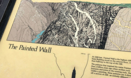
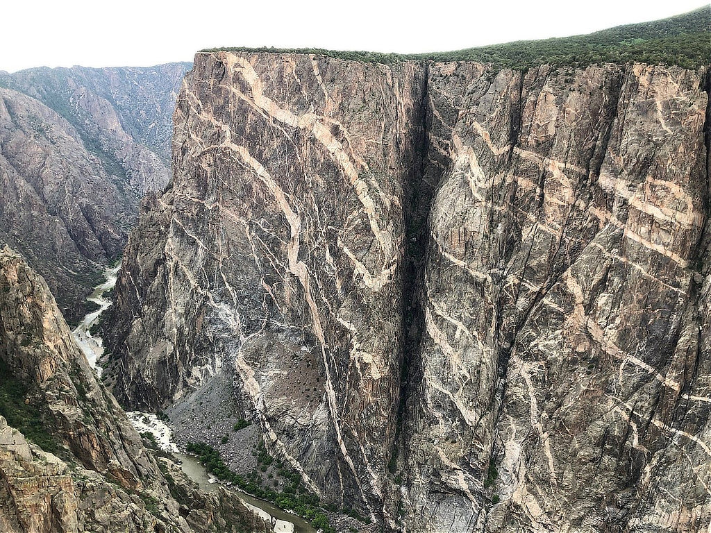
The Painted WallThe Painted Wall is the tallest vertical wall in Colorado. From river to rim it stands 2,250 feet. Pinkish-white veins of rock infiltrate the otherwise dark cliff face. The "paint" actually comes from two different types of rock in the canyon walls. Millions of years, ago molten rock squeezed its way through fissures to form the light colored bands. This rock, known as pegmatite, holds together the other darker rocks along the canyon walls.
|
| The Painted Wall at the Black Canyon of the Gunnison National Park |
 |
Driving Down to the River
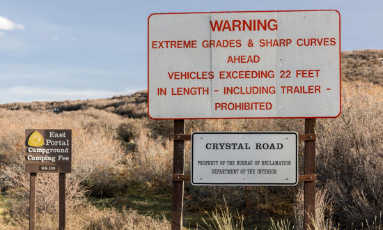
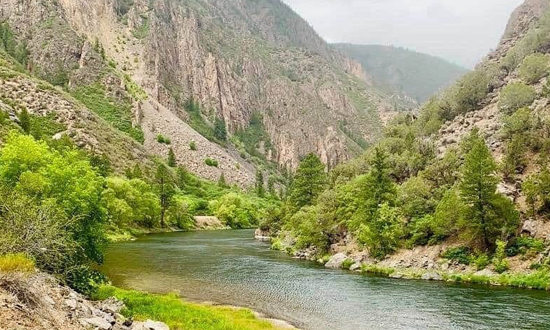
While it is possible for highly experienced climbers and hikers to hike to the Gunnison River, the trails are challenging and unmaintained. The best route to the visit is the East Portal Road. Vehicles over 22 feet in length of prohibited. The road features extreme grades, sharp curves and hairpin switchbacks. It is generally closed by snow from mid-November to mid-April.
The road reaches the river near the Gunnison Diversion Dam, where there are picnic facilities, pit toilets and a campground. The road then continues are another 1.5 miles until it deadends near the Crystal Dam.
 |
 |
Gunnison Tunnel and Diversion Dam 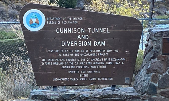 |
Visiting the North Rim
The North Rim is about 11 miles southwest of Crawford.
The North Rim does not have a visitor center, only a ranger station, and is much less developed than the South Rim. Thus, the crowds are smaller in this area.
The North Rim Road is a 4.5 mile unpaved, gravel road, with five overlooks along the way. It begins at the east end of Crawford State Park.
Most overlooks can be reached via only a short walk from the parking area. The road is suitable for all types of vehicles. The most popular views are Exclamation Point and Chasm View (where the walls are 1,100ft apart).
The North Rim is closed in winter, typically from late November until mid-April.
| View from Pulpit Rock Overlook at the Black Canyon of the Gunnison National Park |
 |
Things to Do at the Black Canyon of the Gunnison
A large variety of outdoor activities are popular in the park:
- Rock climbing
- Camping
- Scenic drives
- Hiking nature trails
- Horseback riding
- Fishing
- Wildlife watching
- Cross-country skiing and snowshoeing in winter
- Bird watching
- Astronomy
- Rafting and kayaking - for only experienced watersport enthusiasts
The South Rim Campground is open year-round, with 88 campsites in three loops. There are limited RV services in the park. The 13 campsites in the North Rim Campground are open from April to mid-November.
The East Portal Campground has 15 campsites and is normally open from May to mid-October.
 |
 |
What Weather to Expect
Summer daytime temperatures in the park range between 55 to 90F (13 to 32C), nights 45 to 60F (7 to 16C).
Winter daytime temperatures range between 15 to 40F (-9 to 4C), nights 10 to 20F (-12 to -6C).
Afternoon thunderstorms are common during the summer in the park, so watch for the latest weather forecasts. Snow accumulation varies greatly year to year. Layered clothing is appropriate.
Lodging Near the Black Canyon of the Gunnison
 |
Travel Guide: |
More Popular Travel Destinations in Colorado |
||||
 |
 |
 |
||
|
||||
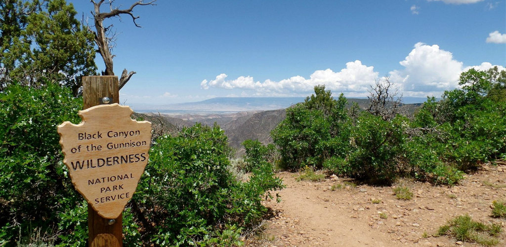 Black Canyon of the Gunnison Wilderness Area |
More Information about the Black Canyon of the Gunnison
Website of Black Canyon of the Gunnison NP at NPS
Official Colorado Tourism Website: Black Canyon of the Gunnison
USGS Website: Black Canyon of the Gunnison
Friends of the Black Canyon of the Gunnison - A nonprofit organization in support of the Black Canyon of the Gunnison National Park
Black Canyon of the Gunnison Travel Guide ... TripAdvisor reviews, photos
